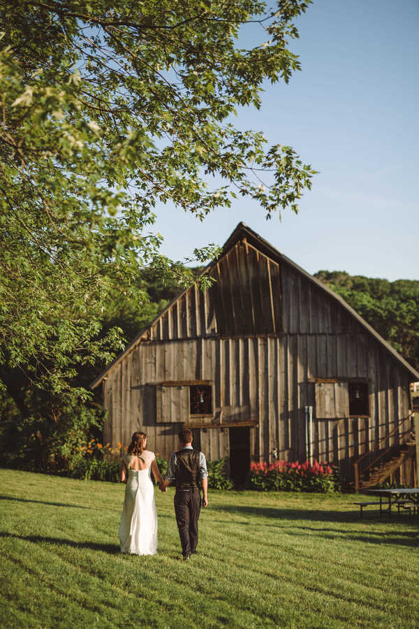
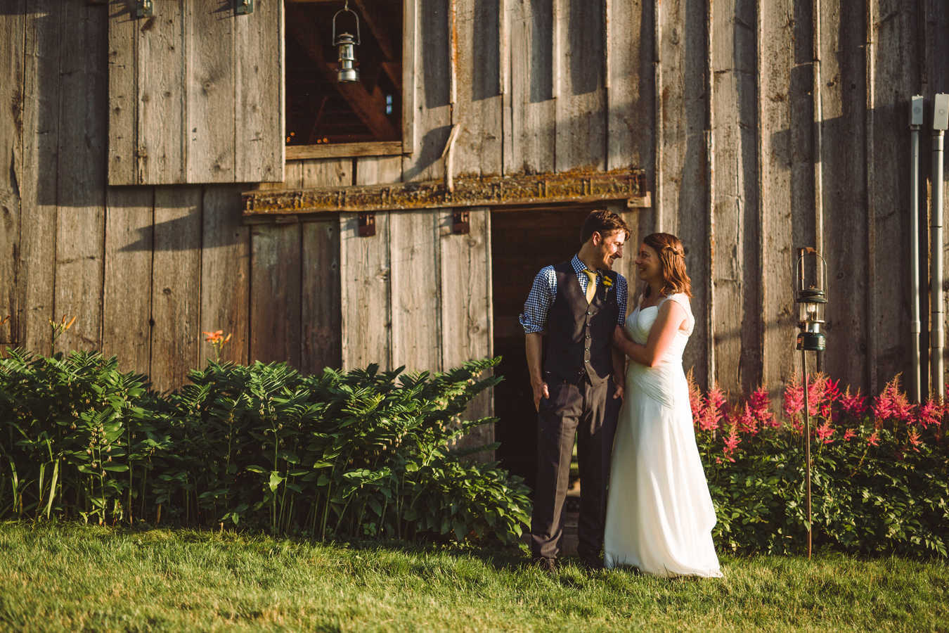
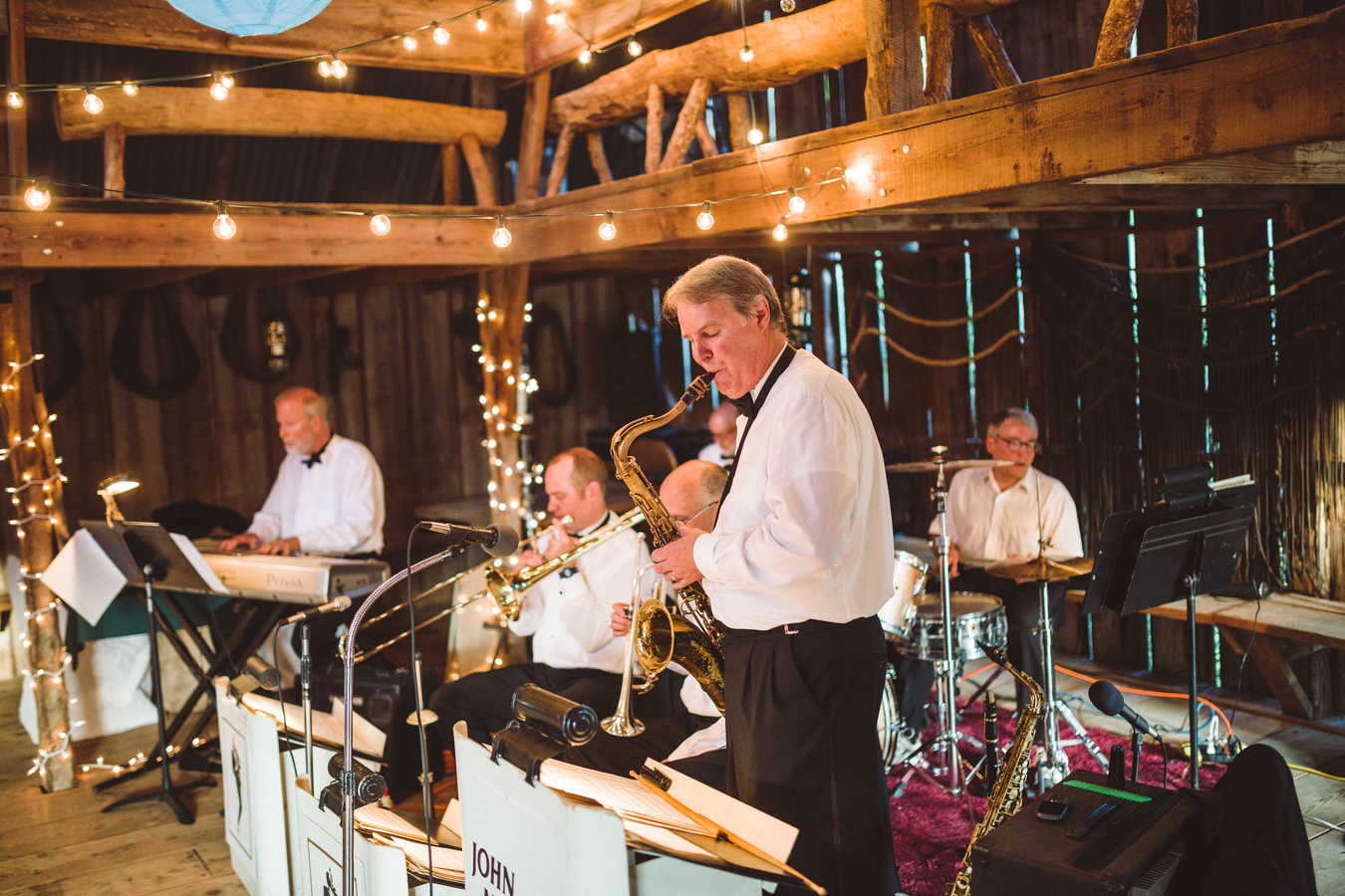
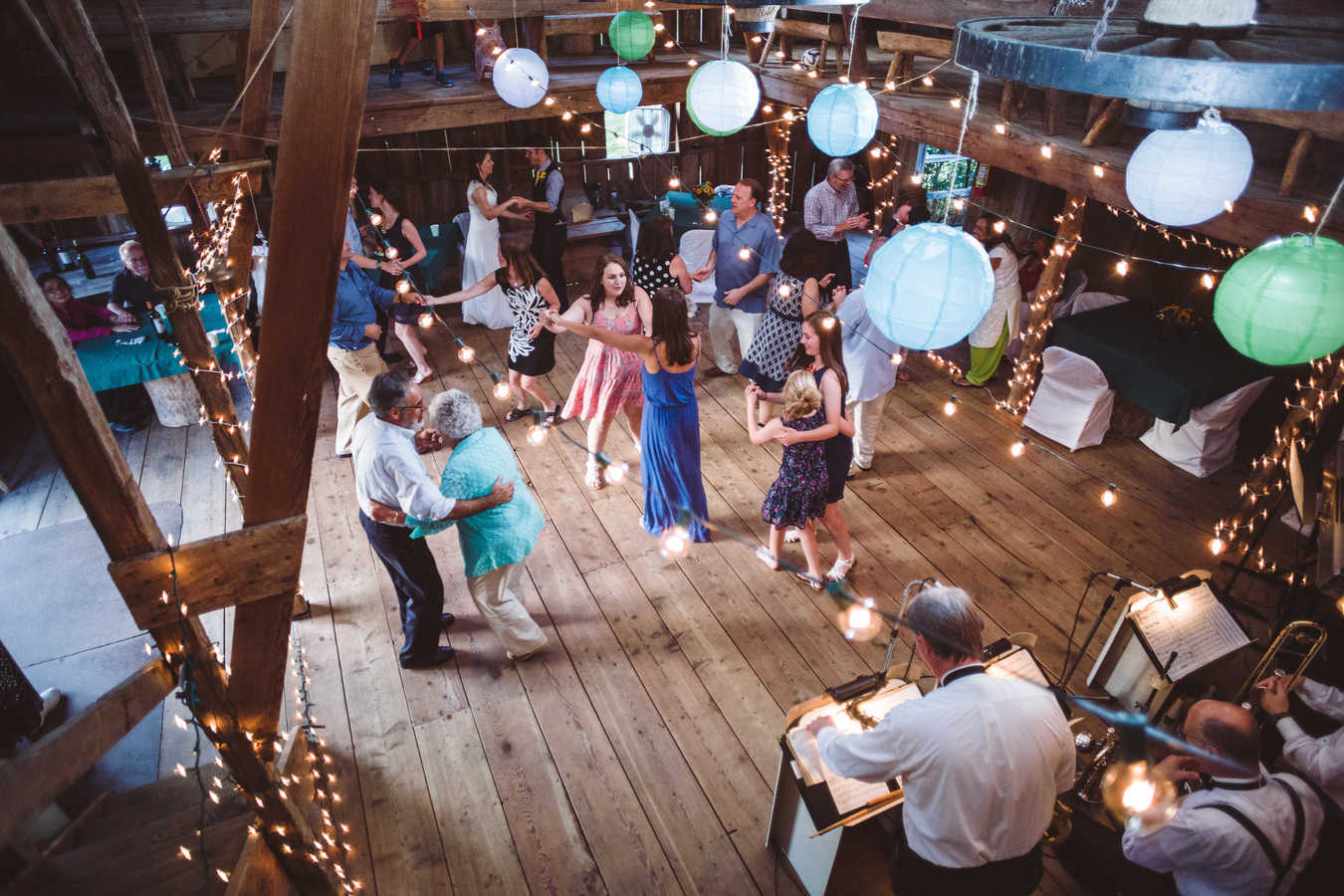
We Got Married!
by Jonathan, October 7th, 2015 | 15 Comments
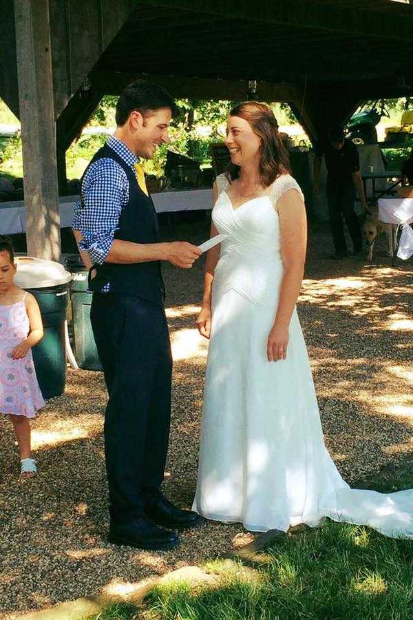
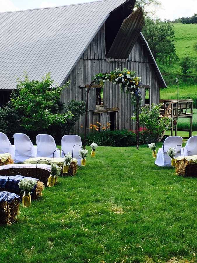
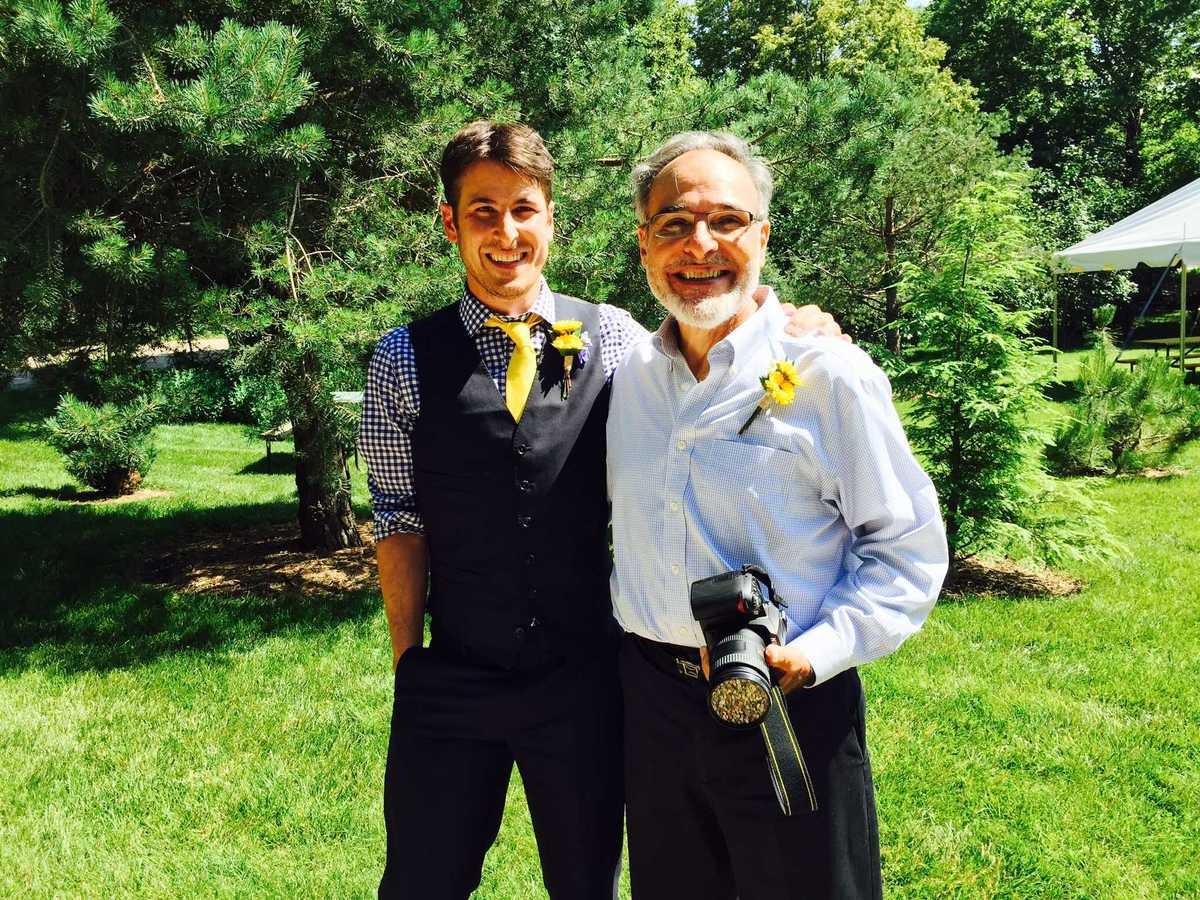
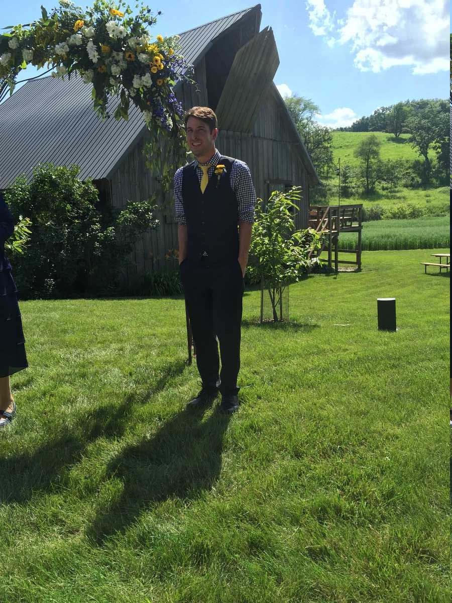
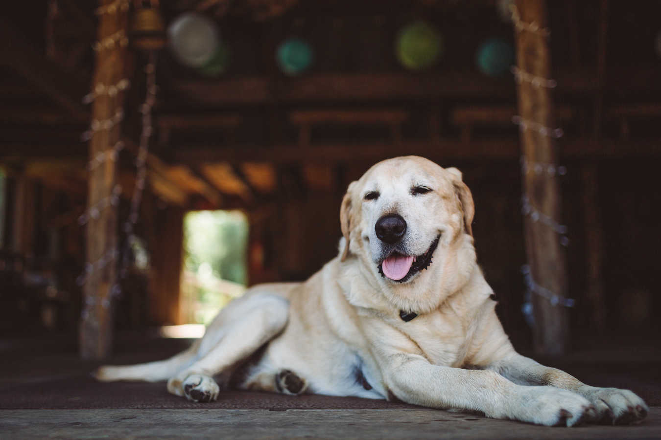
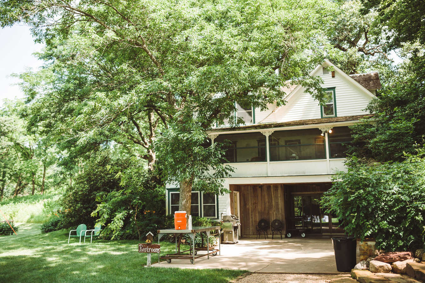
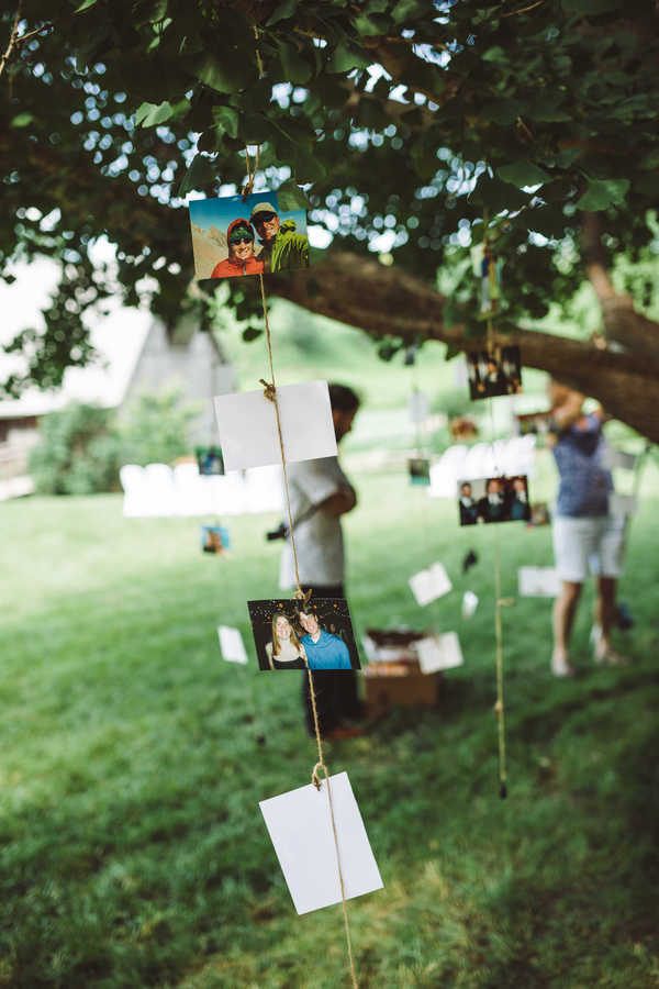
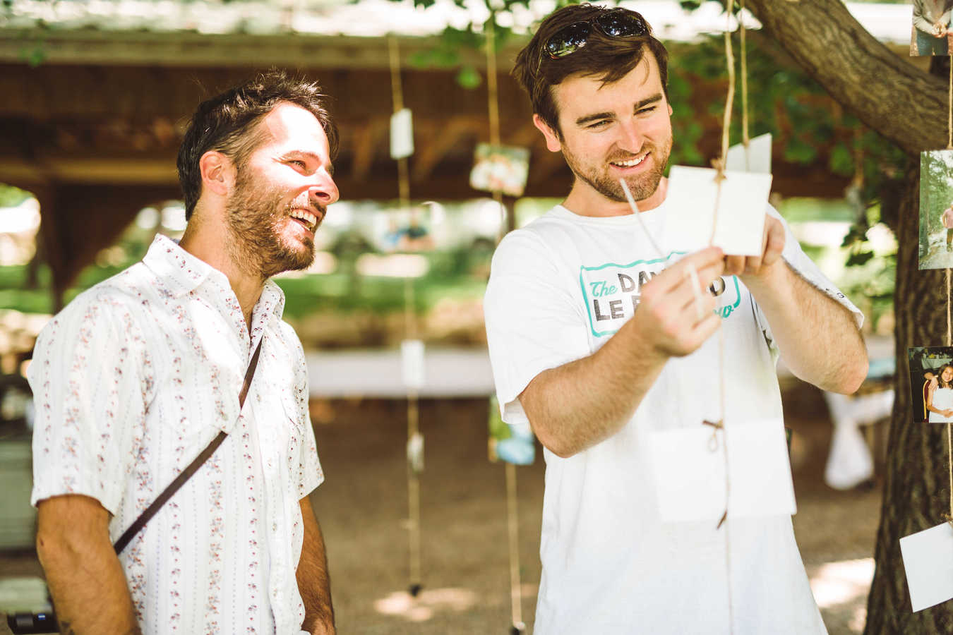
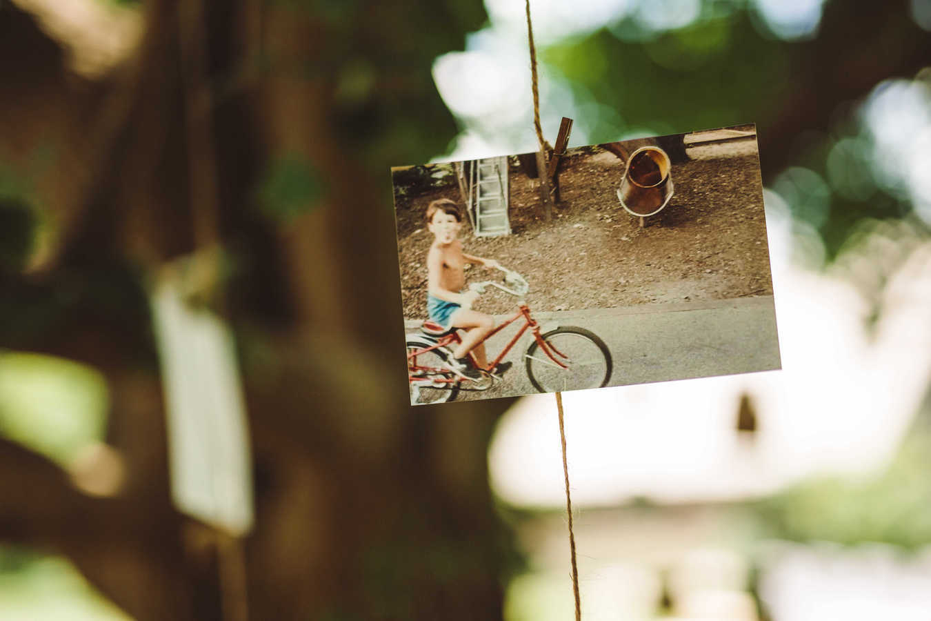
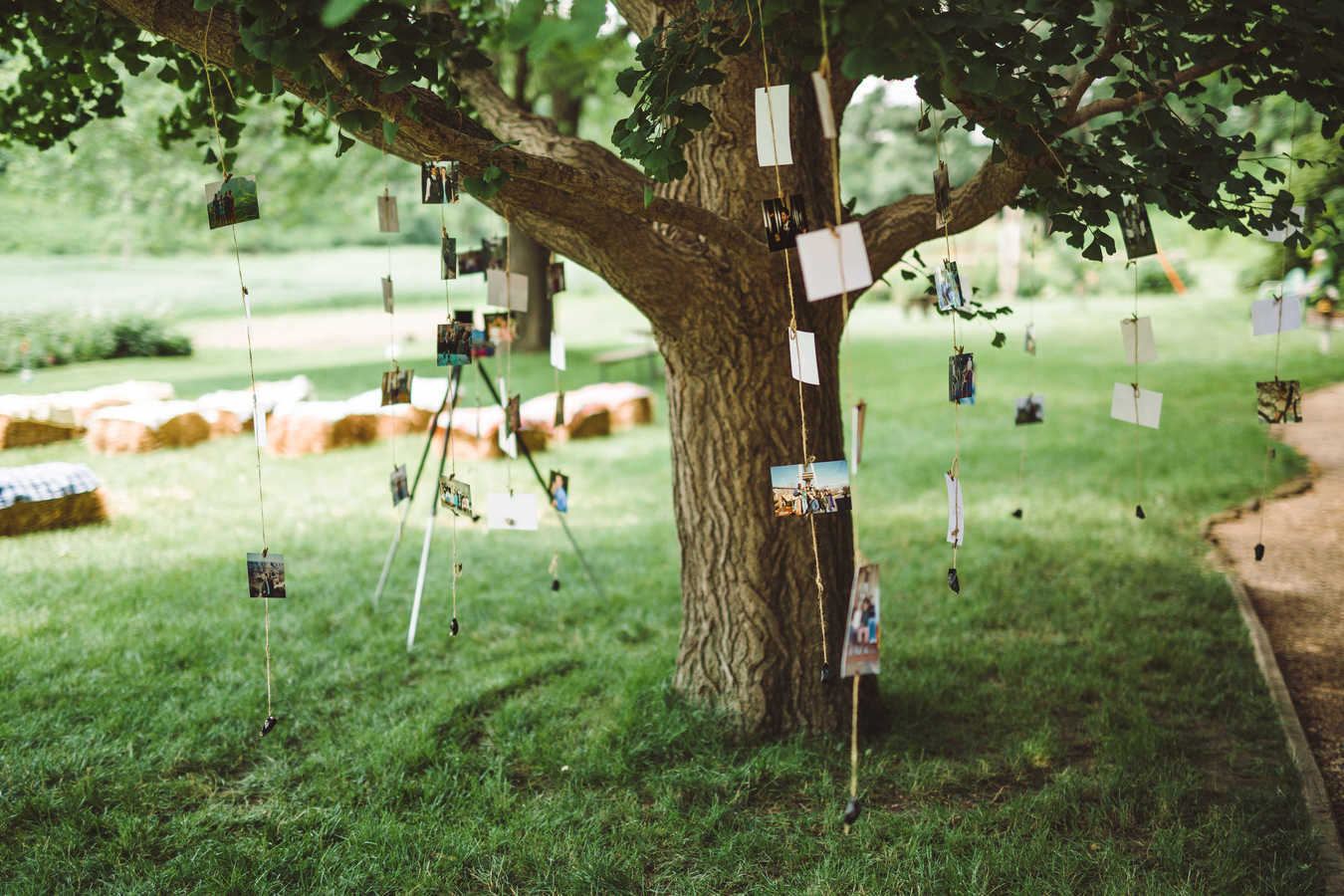
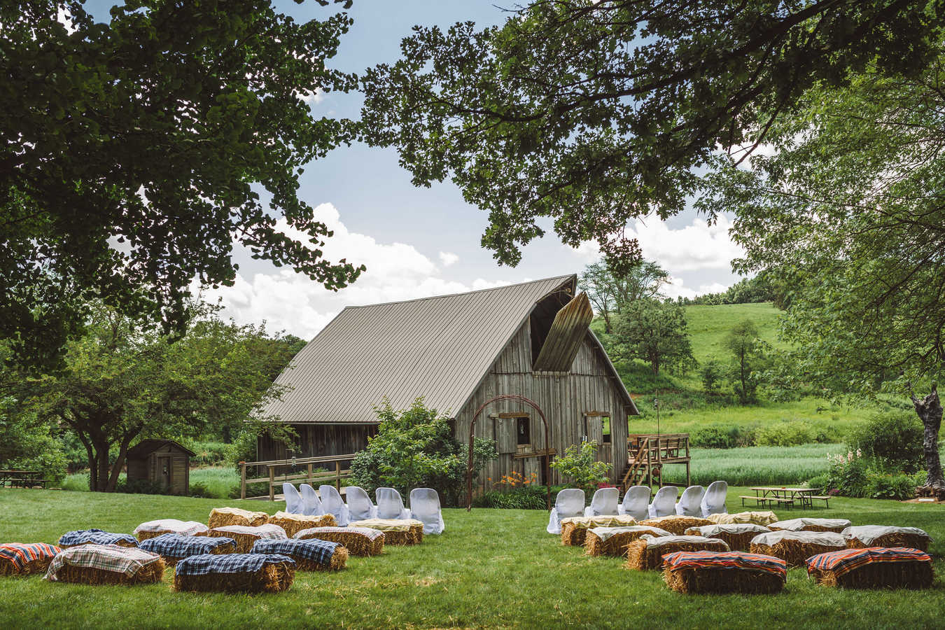
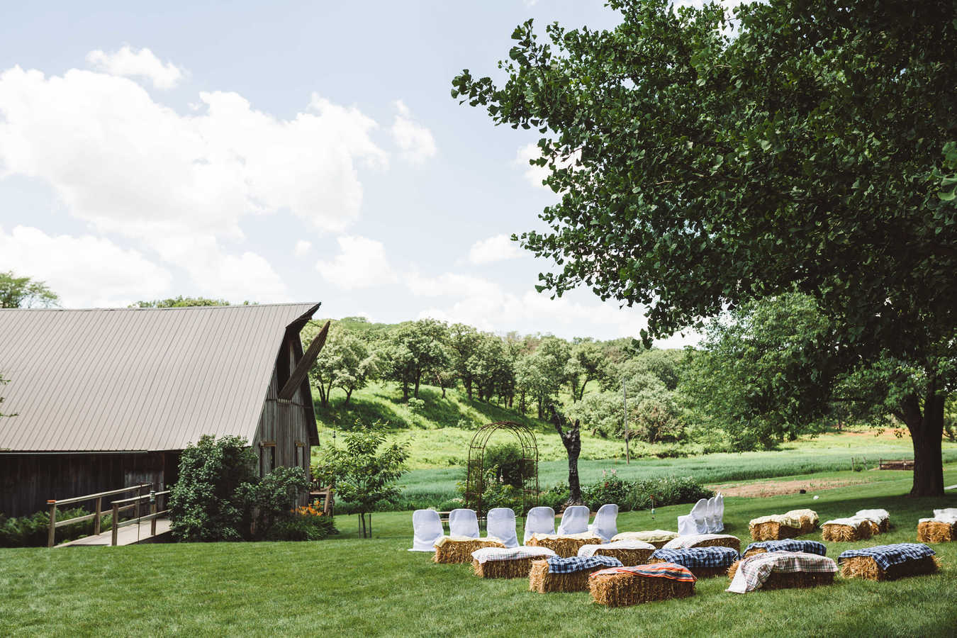
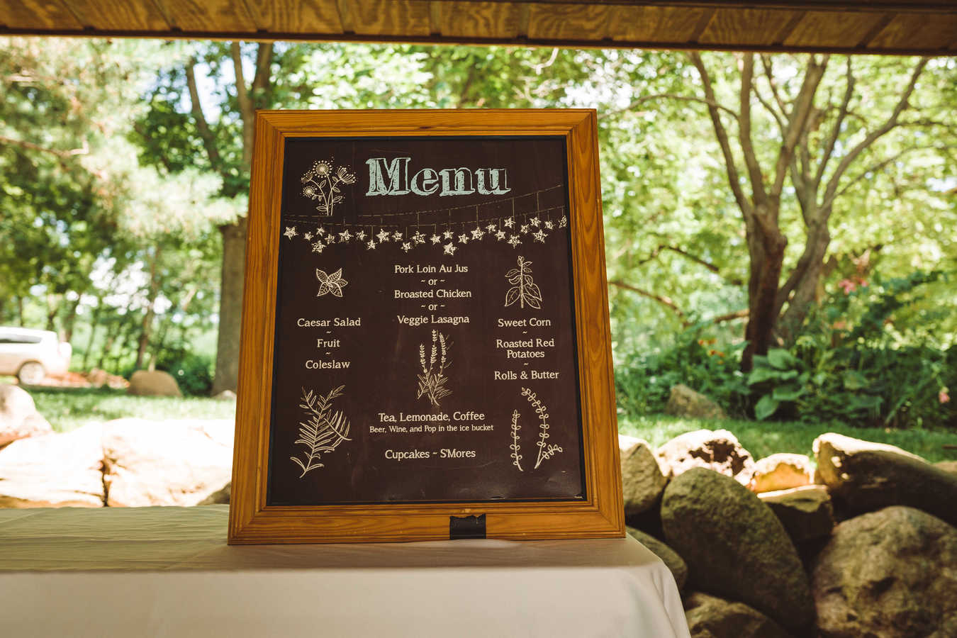
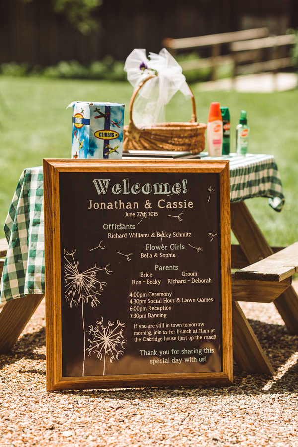
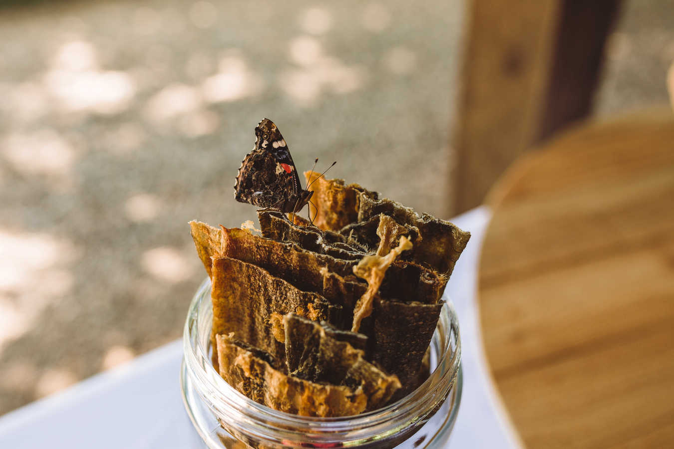
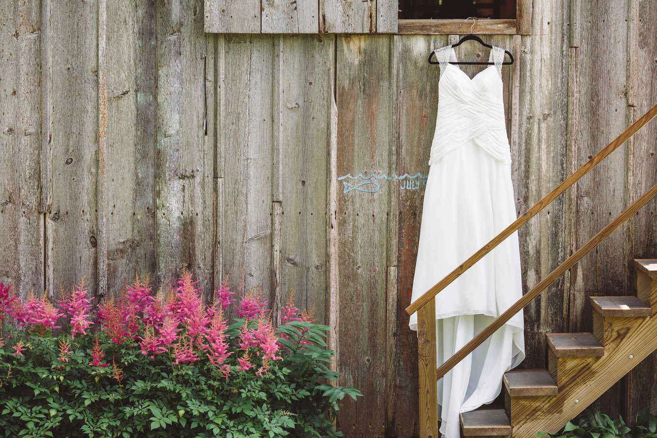
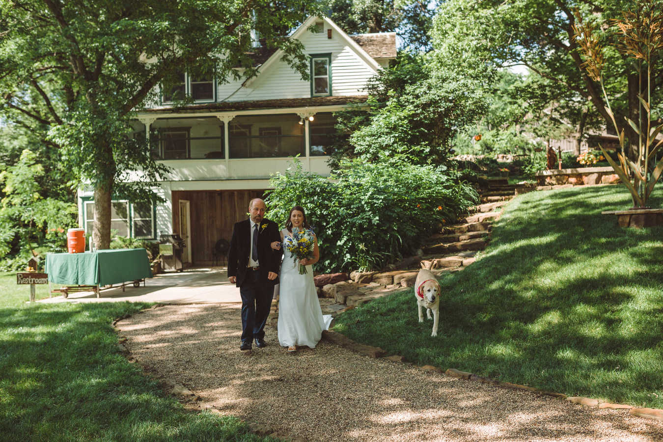
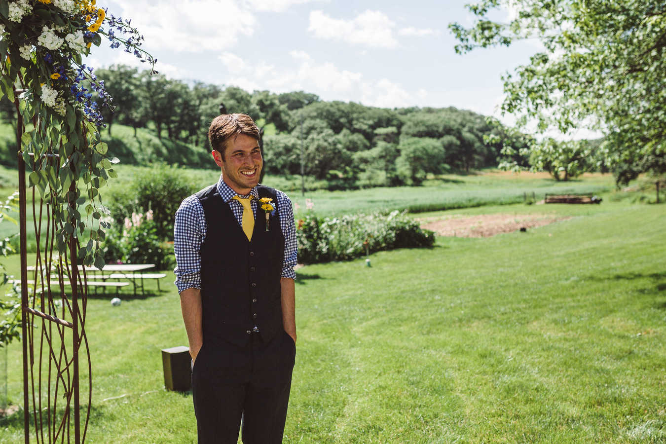
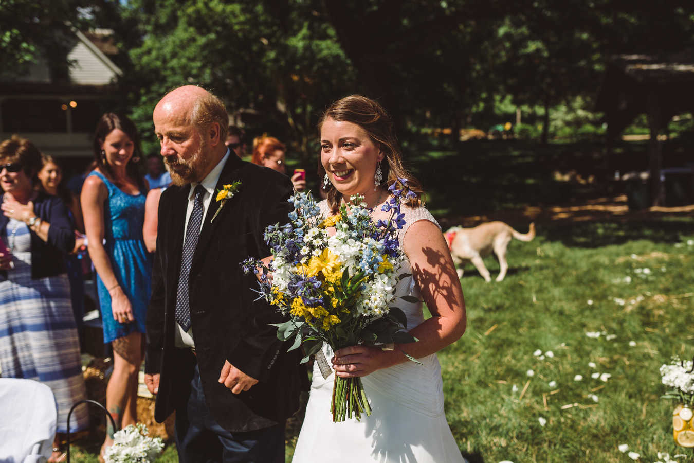
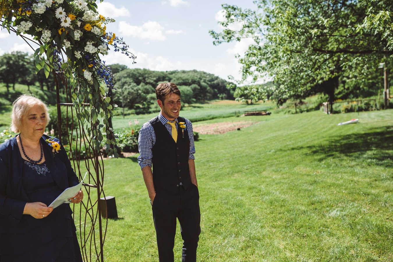
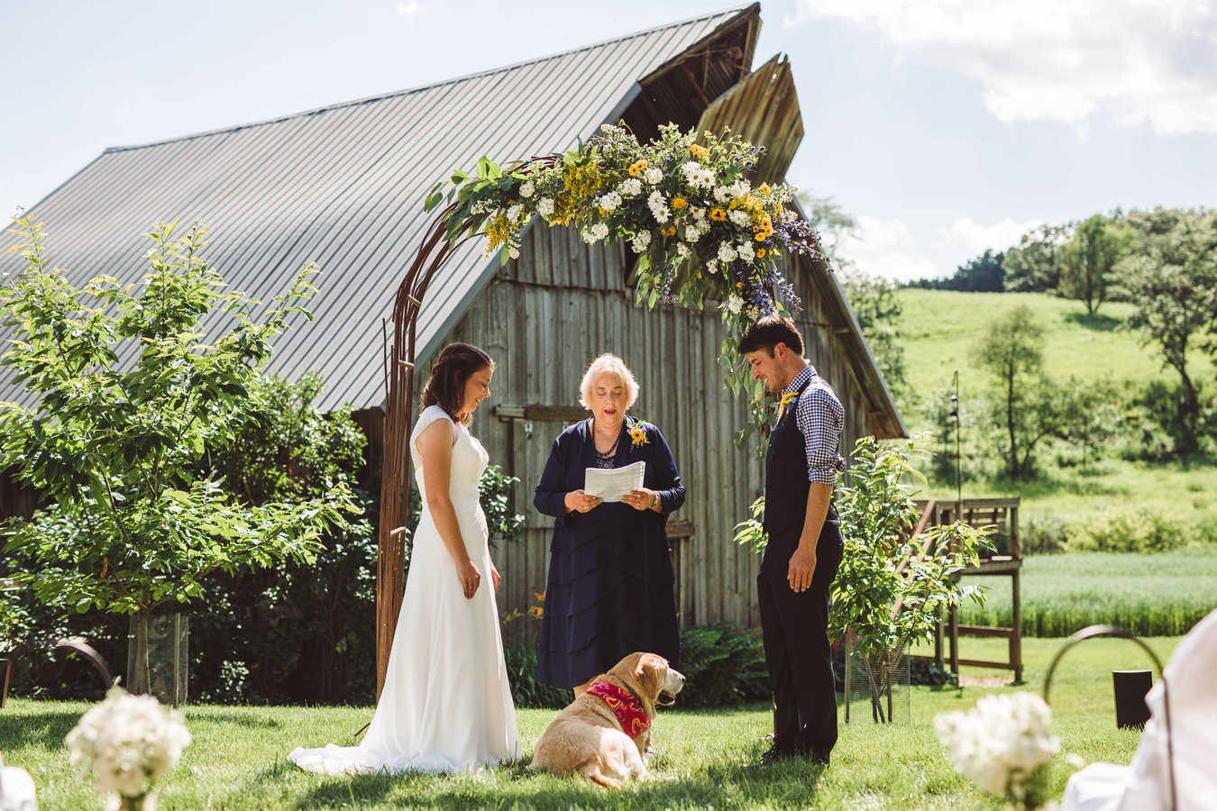
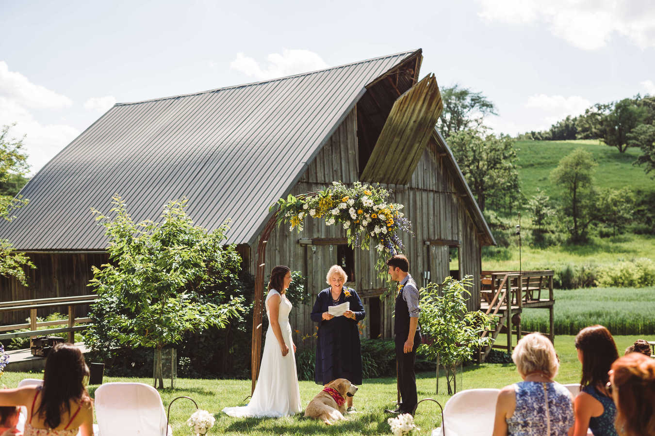
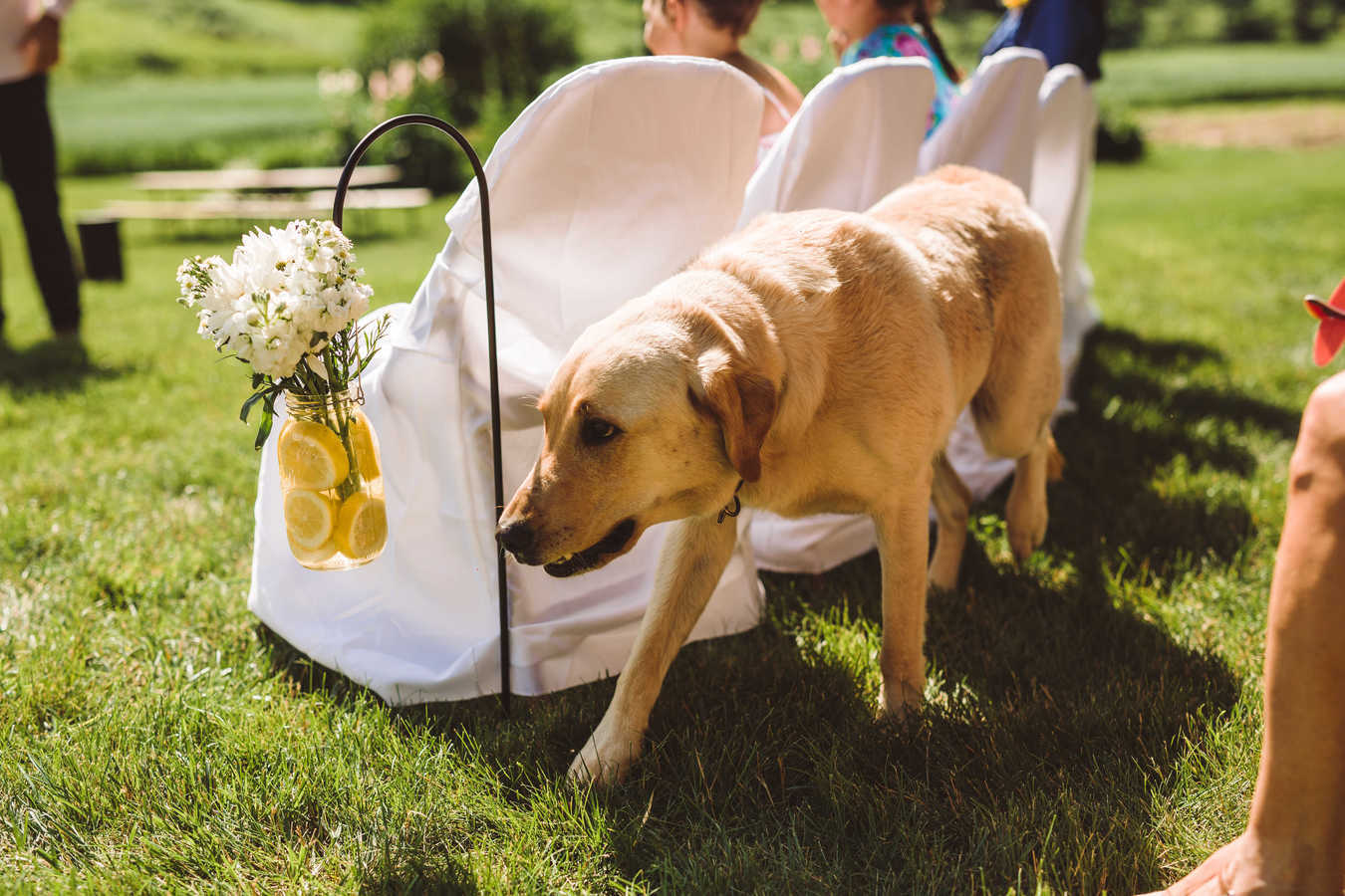
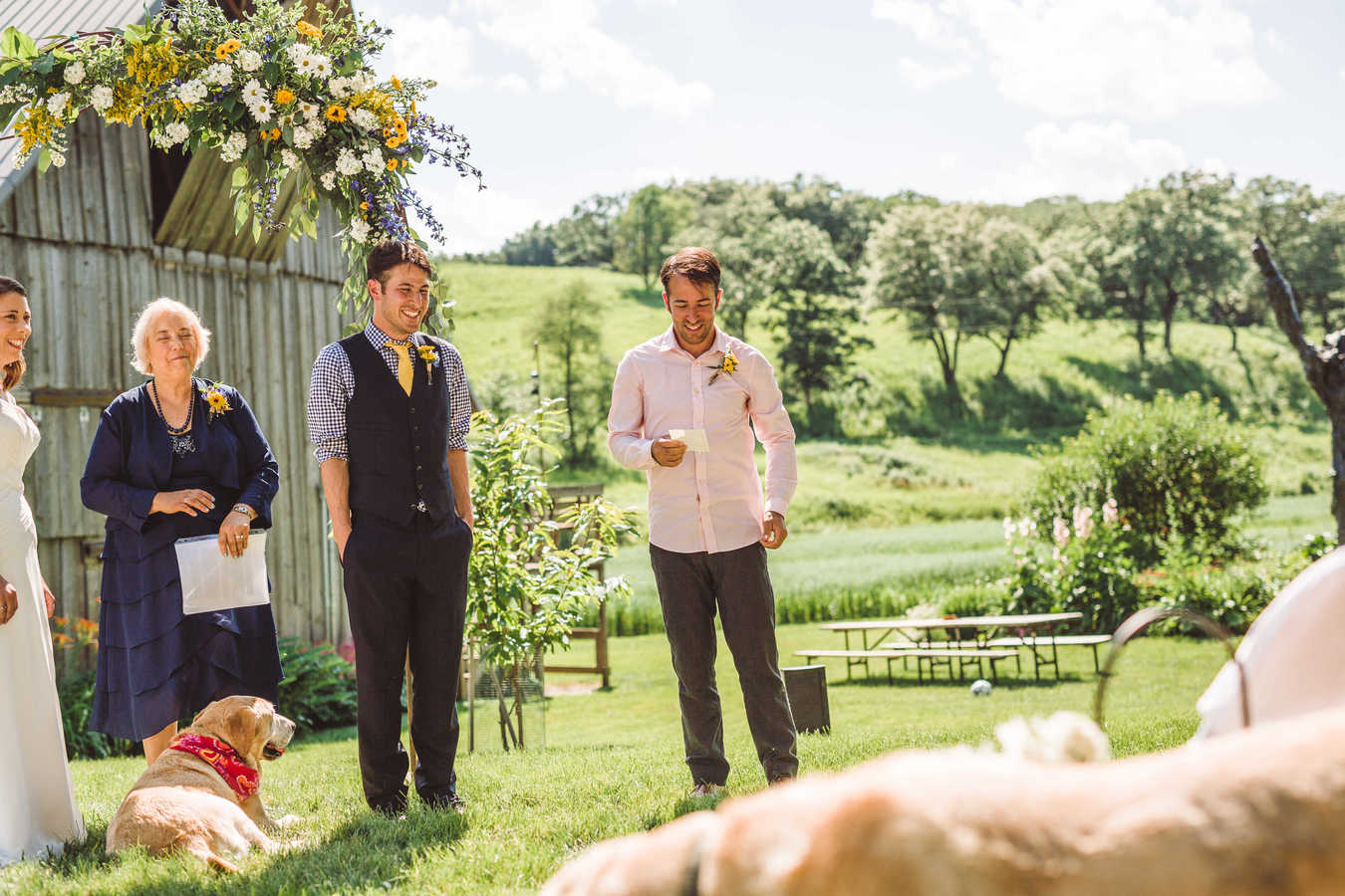
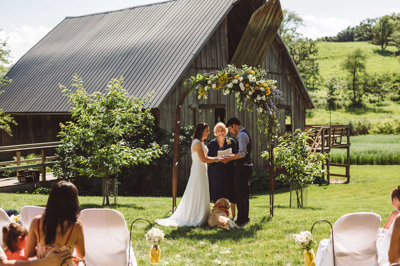
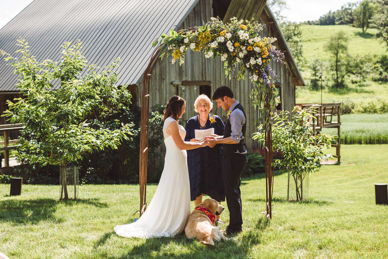
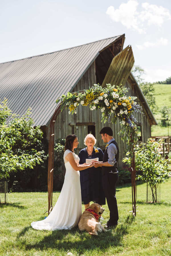
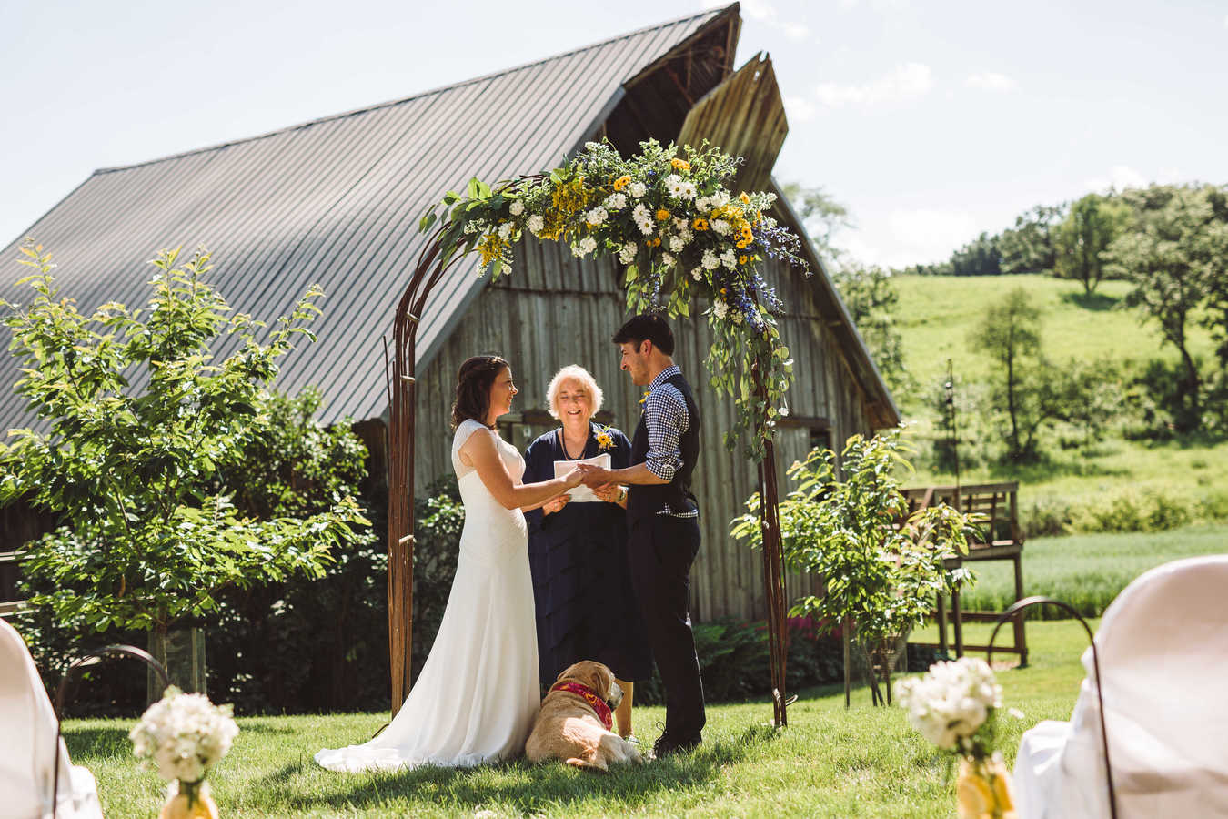
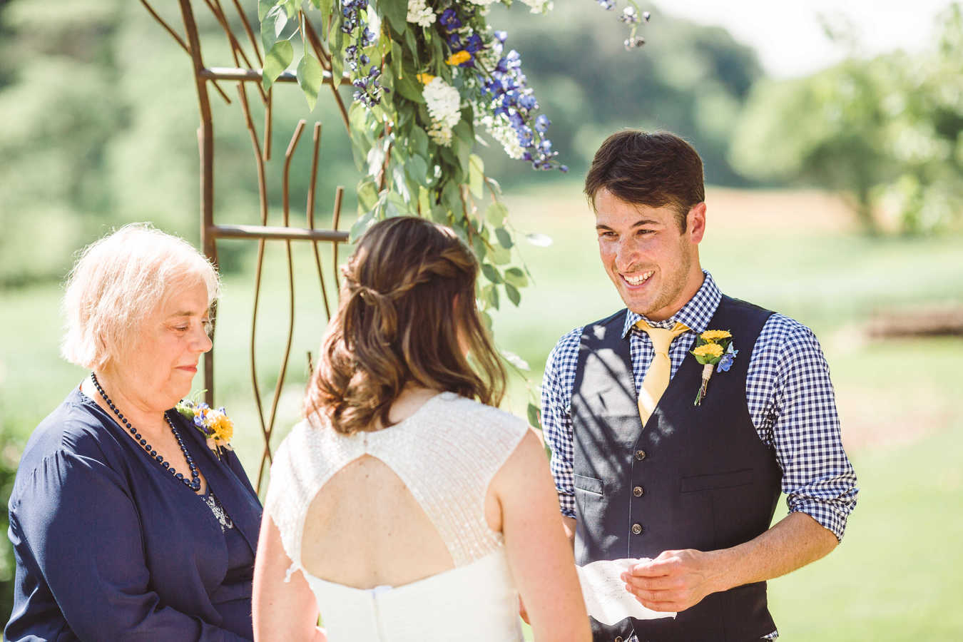
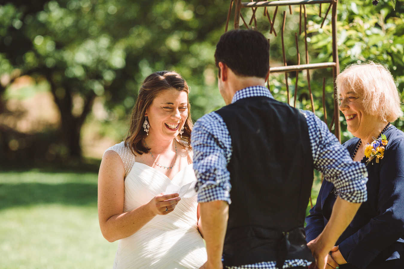
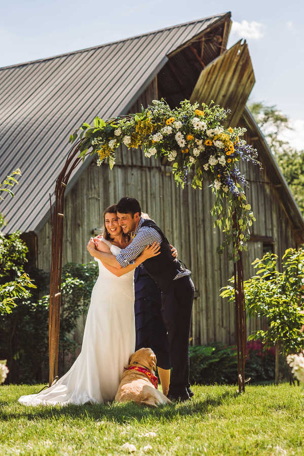
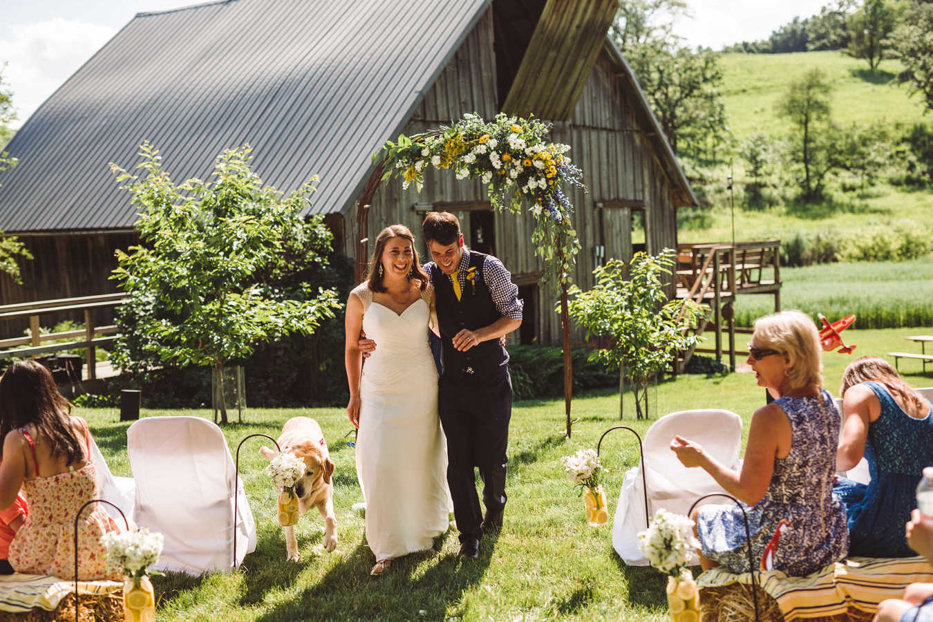
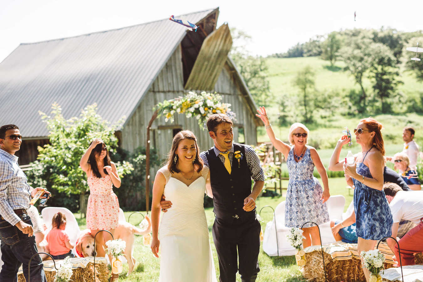
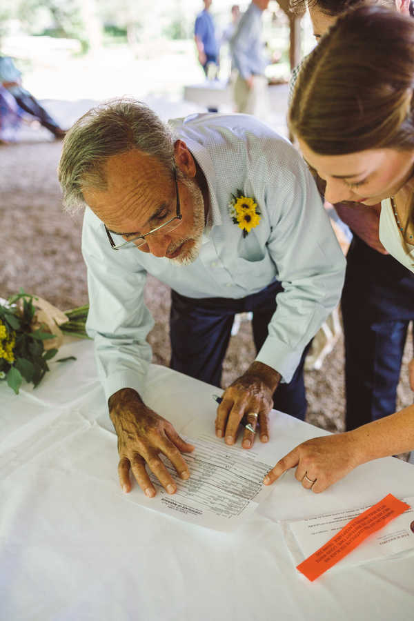
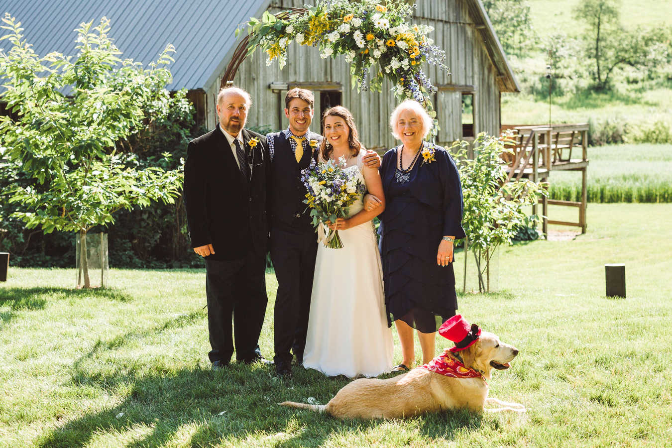
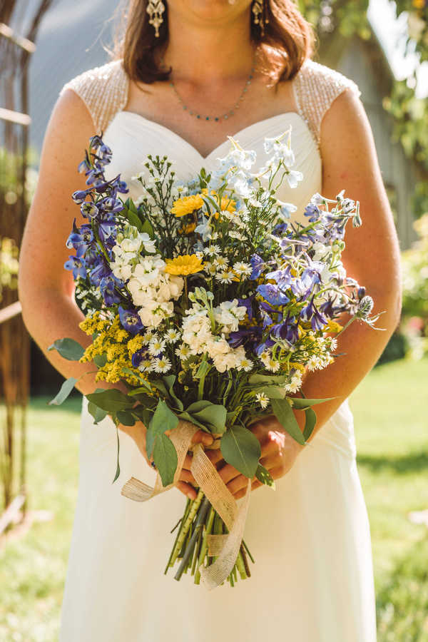
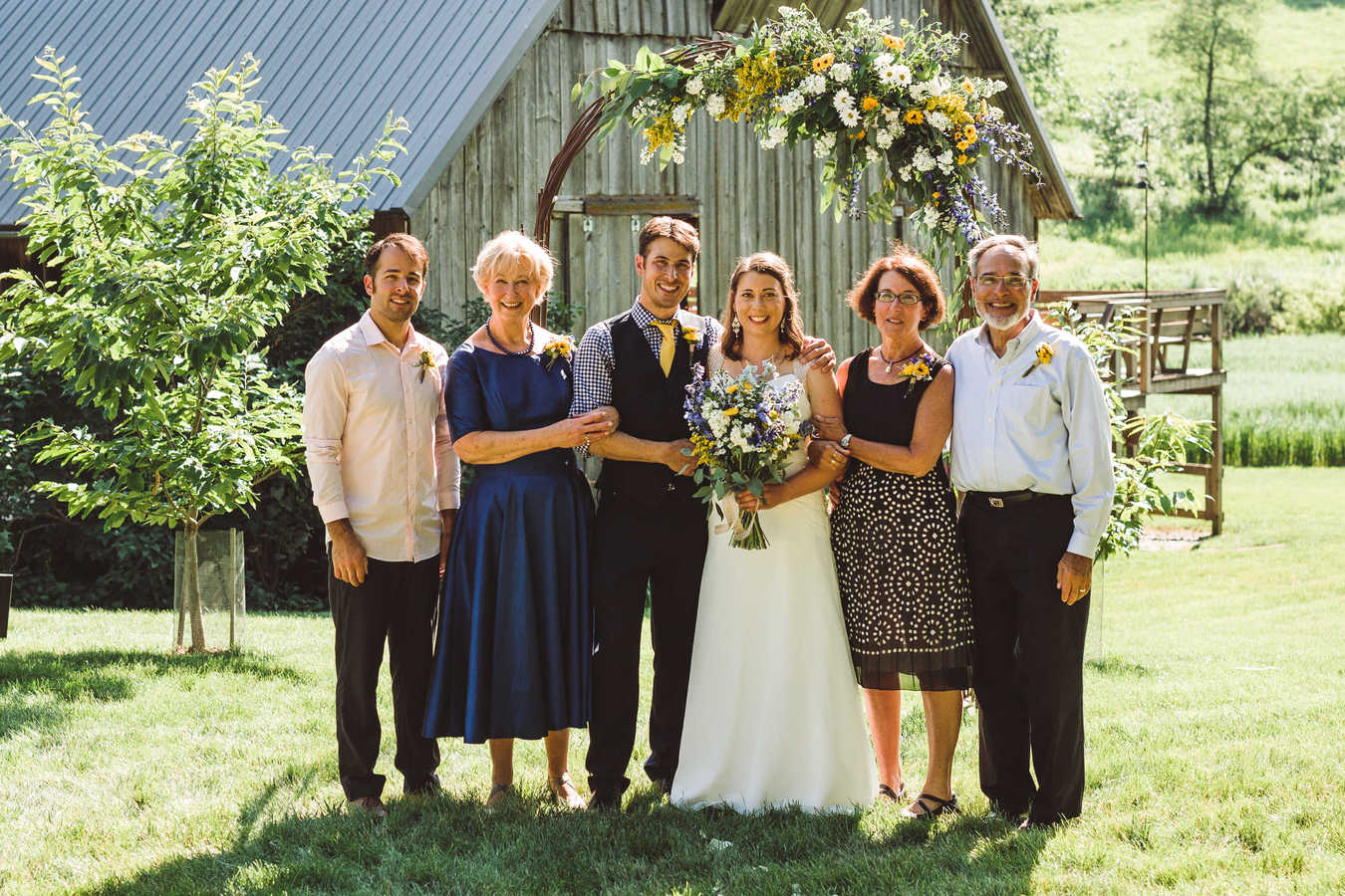
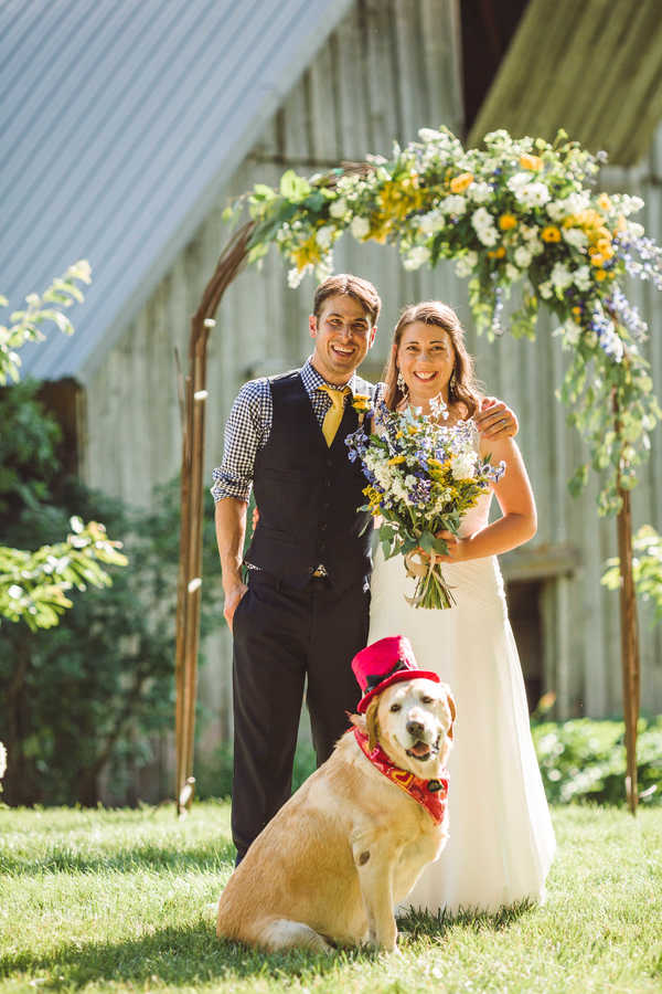
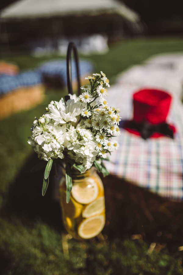
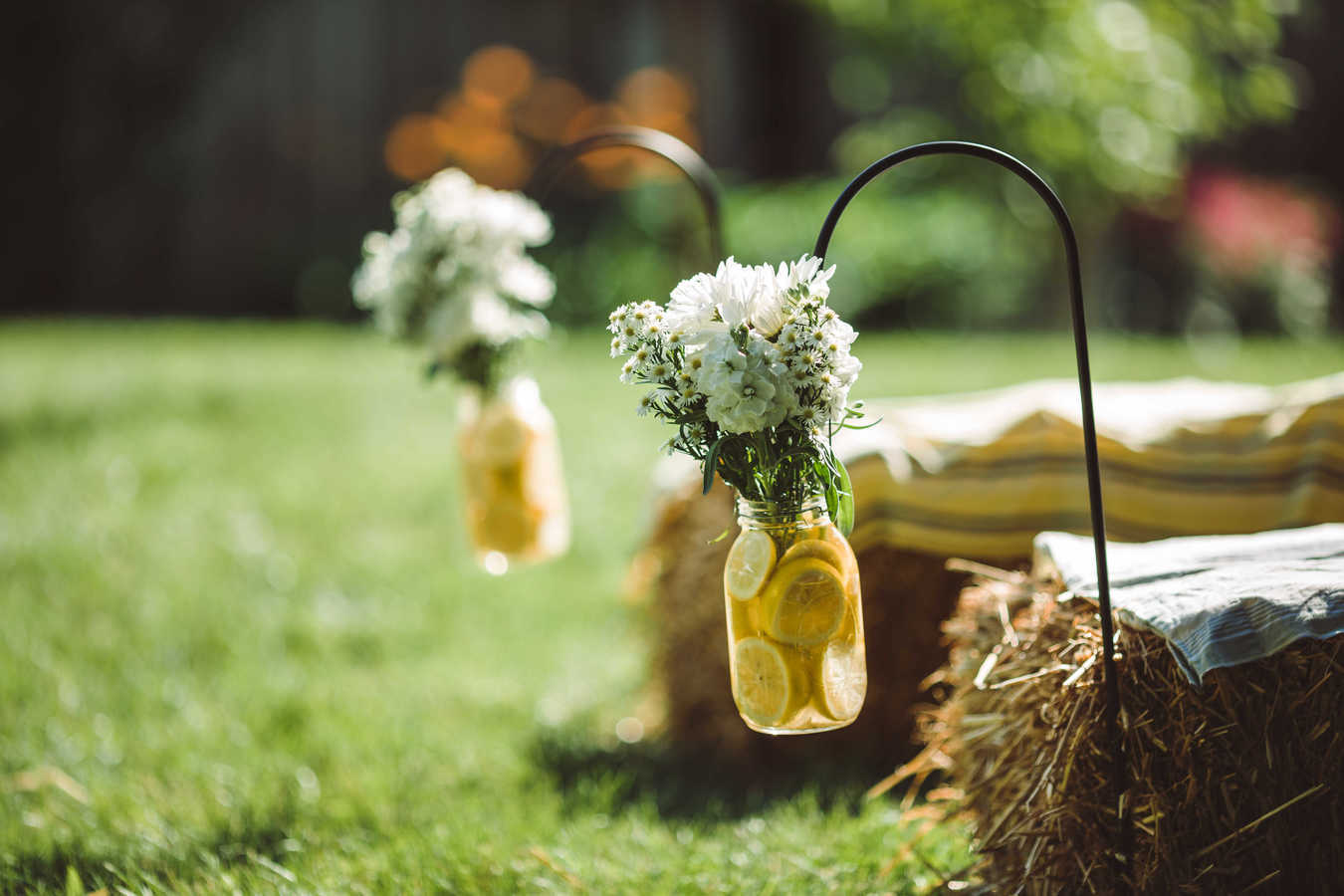
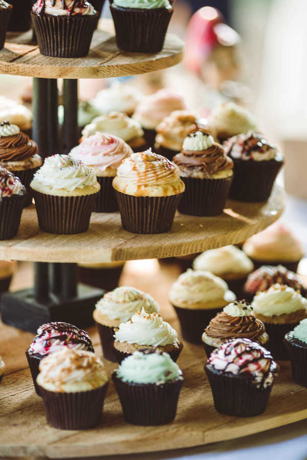
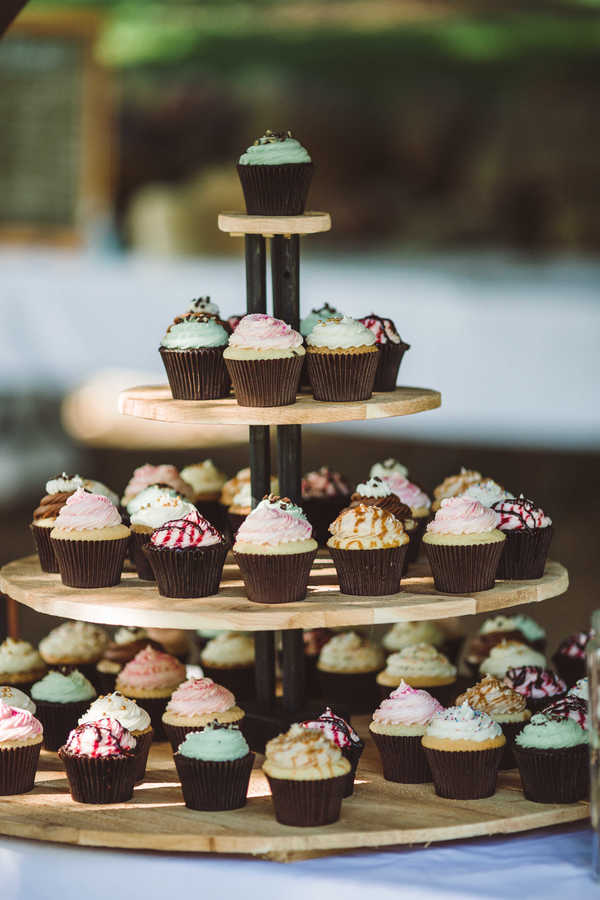
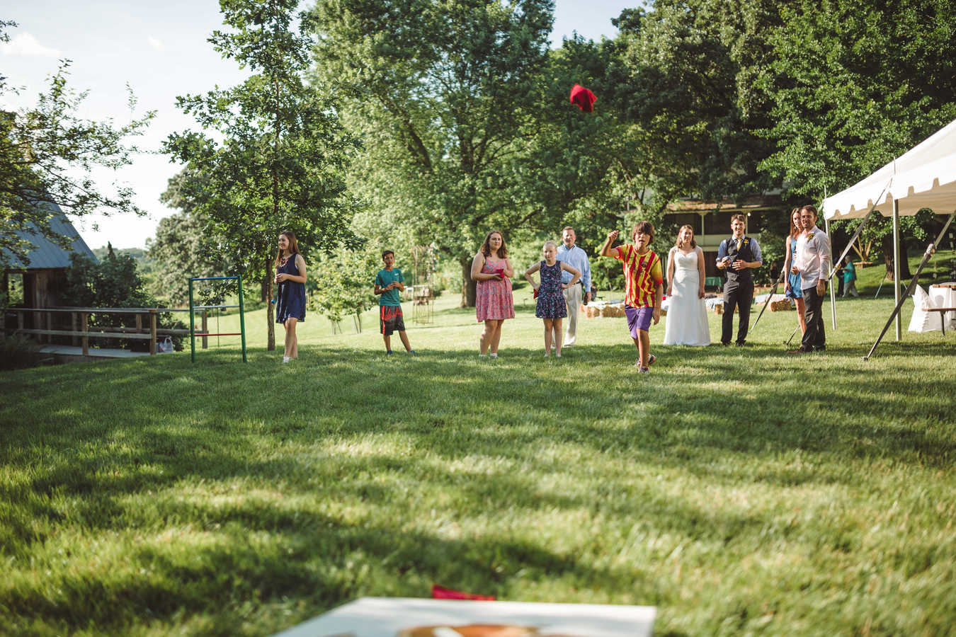
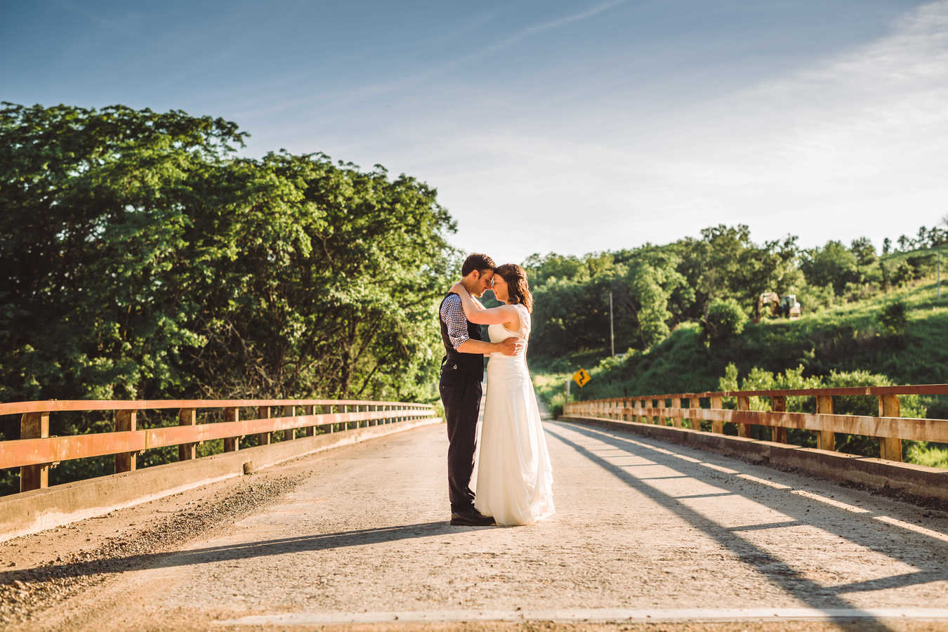
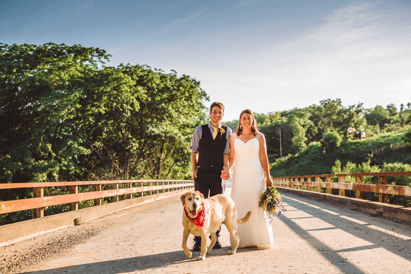
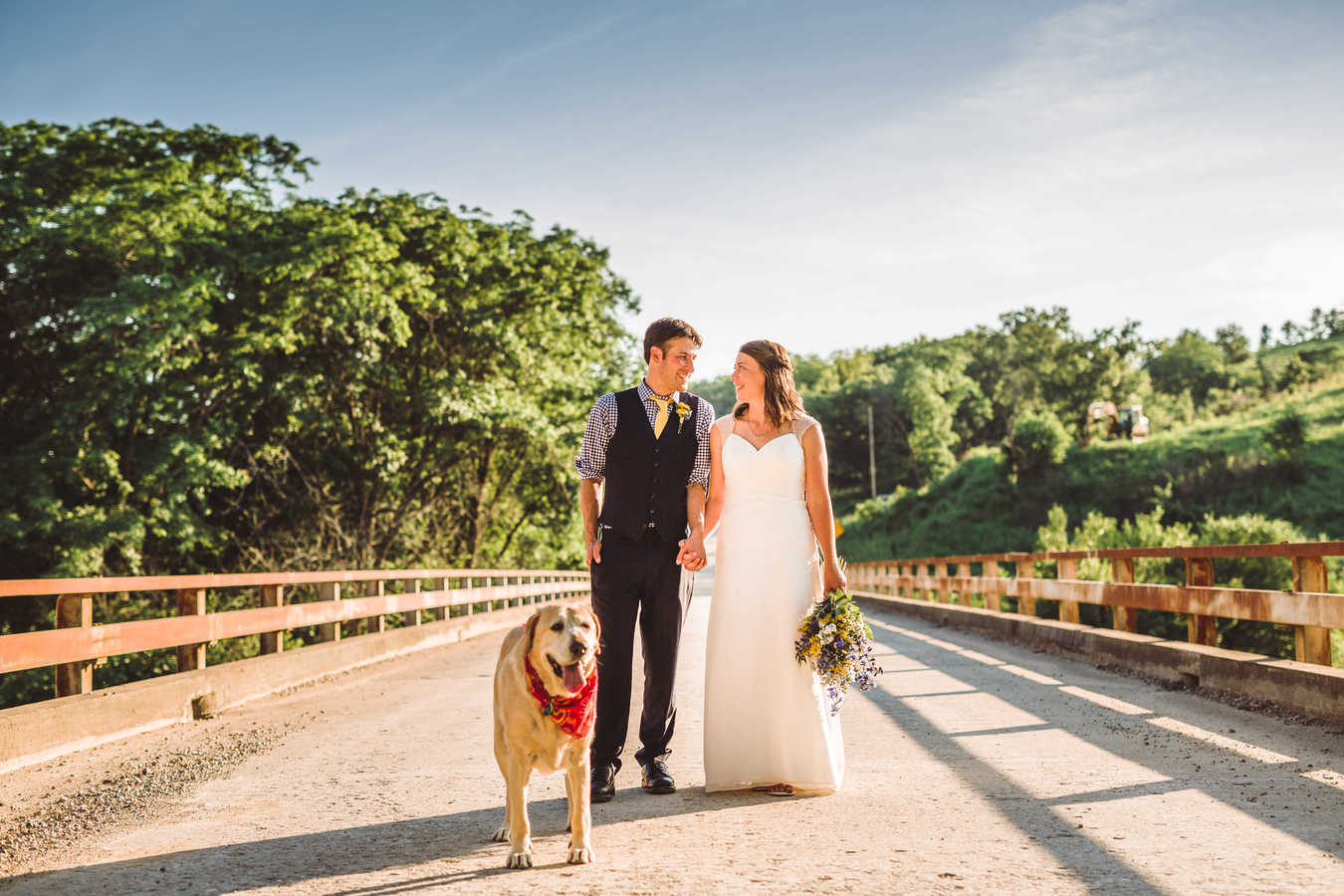
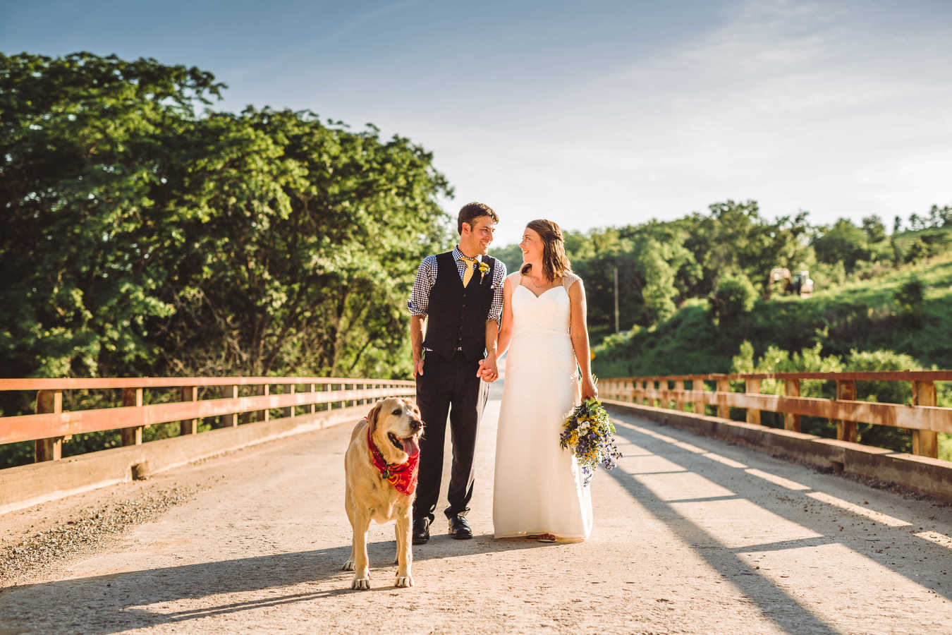
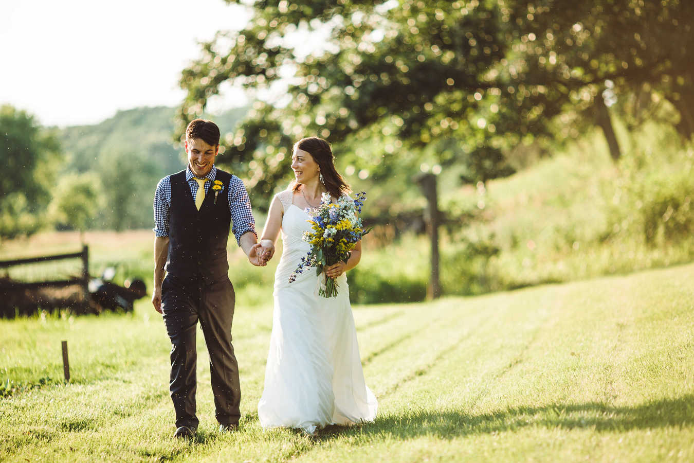
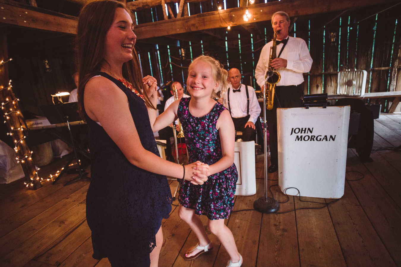
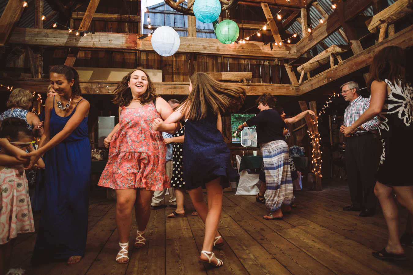
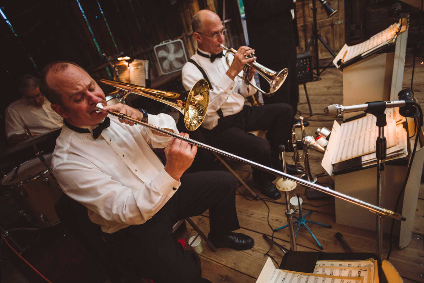
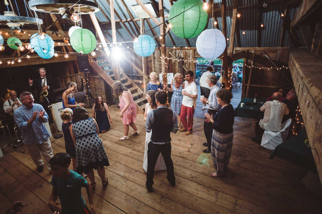
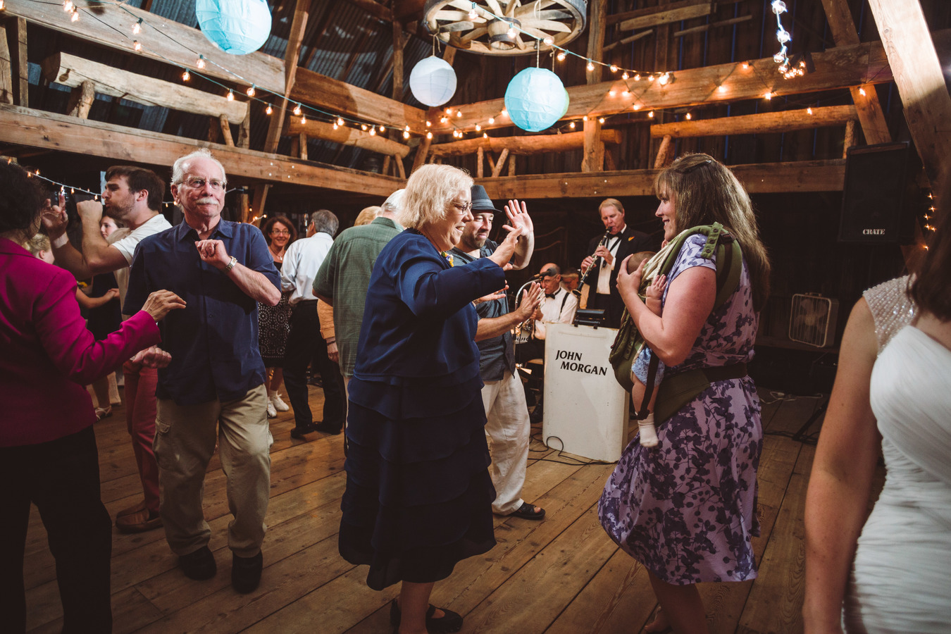
Here are a few photos from our wedding last June at Whiterock Conservancy, Iowa.


by Jonathan, October 7th, 2015 | 15 Comments
Here are a few photos from our wedding last June at Whiterock Conservancy, Iowa.
by Cassie, May 6th, 2012 | 4 Comments
My old lamp shade didn’t survive the move to Seattle. When I was looking for a new lamp shade, I was inspired by a neat lamp shade I saw on Etsy that was decorated with dried plants. I followed these instructions for making my own lamp shade.
On one of my hikes around Seattle, I gathered some plants to decorate my lamp shade.

Gathered plants
Then, I dried the plants for a couple weeks.

Drying the plants
After the plants were dried, I arranged the plants on my lamp shade and glued them on. After the glue had dried, I applied a protective coat of clear acrylic sealer spray.

Finished lamp shade

Lamp shade lit up for the first time
by Jonathan, December 18th, 2011 | 8 Comments
Back when I lived in Chicago, my favorite radio station was XRT. They played all the interesting, undiscovered bands. Sadly, all the radio stations in Iowa are owned by clear channel, so they only play the latest corporate-approved megastar. XRT’s website has a list of all the songs they’ve played in the last day. So I created a program which takes that list, finds those songs somewhere out on the internet, and generates a playlist of it all. To try it, paste the url http://www.jonathankoomjian.com/projects/xrt/playlist.m3u into your computer’s music player.
After I finished this project, I discovered XRT has gone all baby boomer on me – now they mostly play The Police and Natalie Merchant 🙁
The one saving grace of the whole endeavor is that sometimes the program gets random covers of the song it was aiming for. And it turns out the covers are way more interesting than the originals. Here are some of my favorites:
Hey Jude performed by a marching band:
http://anchorbaybands.org/music/Marching%20Band/CBML_HJ_BMBS_Live.mp3
The cranberries song in korean
http://lapulce.freeflux.net/files/audio/01-faye-wong-dream-person-cantonese-.mp3
Diana Ross sung by by 2 Japanese ladies who don’t know any English:
http://www.youtube.com/watch?v=sTvVMjnBePM
by Jonathan, November 10th, 2011 | 5 Comments
Since getting back from South America, Cassie and I have been going through a bit of camera withdrawal – we took an average of 43 photos a day down there, but now that we’re back to our normal lives, and there are no mountains or palaces to photograph, we’ve been trying to come up with unusual ways to photograph the everyday stuff around us. Here are three that turned out well.
1. Ride with the Roomba – this is the view from the roomba as it cleans our apartment. Its a time lapse video 4 times faster than real life.
2. 24 hours of the view out our apartment window compressed into 45 seconds.
3. View from the dome of the Iowa State Capitol.

by Cassie, October 12th, 2011 | No Comments
On our second trip to Peru, we visited the more remote Incan ruins, and Vitcos was the most remote ruins we visited. It is difficult to get to Huancacalle independently (See the notes at the bottom for instructions on how to get Huancacalle on your own). Huancacalle is the starting point for the difficult hike to Vilcabamba (Espiritu Pampa), so most tourists visit Huanacalle as part of their organized hike to Vilcabamba. We had to endure several uncomfortable rides in shared taxis (colectivos) with four people crammed in the back seat in order to get to Huancacalle. However, it was worth it to see the ruins of Vitcos and the White Rock. Vitcos is not visited by many people. We were the only ones that were there on the day we visited, and the INC did not bother to staff the checkpoint to collect the entrance fee. Vitcos has not been reconstructed like many of the other Incan sites, and in the temple, there were lintels for the doorways that had fallen to the ground. Vitcos has a great defensible position. It has only a narrow strip of land for entering the site, and the rest is surrounded by steep mountainsides. It also has a great view of all the mountain passes leading into the valley.

Vitcos
Manco Inca retreated to Vitcos after losing the battle for Cusco. When Manco first arrived at Vitcos, he was relieved and thought he had outrun his Spanish pursuers. He celebrated with a festival, but he did not realize that the Spaniards were still hot on his trail. They caught Manco by surprise, and the Incans were very drunk at this point in the festivities. Manco survived only because the Spaniards’ greed for the gold they found at Vitcos distracted them and gave Manco enough time to escape. The Spaniards could have taken Vitcos at this time, but their leader, Orgoñez, was recalled to Cusco to participate in the civil war going on between the two factions of conquistadors. Manco Inca ran his rebel empire from here for many years, but later, the Incans were forced to retreat further into the jungle to the last city of the rebel Inca empire, Vilcabamba. Ironically, Manco Inca was killed on the principal plaza in Vitcos by the same assassins that killed Francisco Pizarro in Lima. The assassins fled to Vitcos after killing Pizarro, and Manco welcomed them since he considered any enemies of Pizarro his friends. However, later, the assassins worked out a deal for a pardon from the Spanish authorities if they killed Manco Inca, and they stabbed him while they were in the middle of playing a game with him. I can’t imagine how the assassins believed they would be able to escape with their lives after killing the Incan emperor, and they were quickly caught and killed.

Room in the temple that hasn't been reconstructed- you can see the fallen lintels for the doorways
Nearby Vitcos is the White Rock. It was a sacred carved rock with a temple and natural spring running around the rock. The White Rock is huge- 50 feet in length. The rock is carved to mirror the mountains around it similar to the sacred rock at Machu Picchu. There are actually two huge carved rocks next to Vitcos, and we mistakenly thought that the first rock we came to was the White Rock. However, the actual White Rock is a little farther up the trail.

Another sacred rock that we originally thought was the White Rock

The White Rock!
Manco Inca’s son Titu Cusi invited two friars to stay at Vitcos, and the friars believed that the White Rock was devoted to devil worship. They burned down the temple next to the rock and performed incantations to banish Lucifer from the area. Obviously, this action angered the Incans greatly, and the friars were nearly killed. However, Titu Cusi was generous and spared the friars’ lives. The more zealous Friar Garcia was banished from the Incan empire. The other Friar Ortiz was allowed to stay, but this decision would not serve him well later. When Titu Cusi suddenly died from an unknown illness, the Incans blamed Friar Ortiz for his death, and Friar Ortiz was tortured and killed.
It was very interesting to visit an Incan site that has so much history, and it was definitely one of the highlights of the trip.
How to get to Huancacalle independently: We hiked along the train tracks from Aguas Caliente to the train station at the hydroelectric plant, but you can also take a train. From the hydroelectric plant, take a shared taxi to Santa Teresa from the train station. In Santa Teresa, go to the bus terminal and you will find a line of shared taxis waiting to take you to Santa Maria. From Santa Maria, take another shared taxi or micro to Quillabamba. You will actually pass through the town of Chaullay shortly after Santa Maria, which is at the junction to the road that goes west to Huancacalle. However, from Chaullay, the only way to get to Huancacalle is an uncomfortable two hour ride on the back of truck, so it is best to continue past Chaullay to Quillabamba where you can get another shared taxi to Huancacalle and retrace your steps back to Chaullay.
How to get back to Cusco from Huancacalle: We made the mistake of heading back to Santa Maria and trying to get transport to Ollantaytambo from there. However, it is better to go from Huancacalle to Quillabamba and get a bus from there. We had to wait several hours in the sweltering heat in Santa Maria before the bus came. However, since we didn’t have tickets for the bus, we spent several uncomfortable hours standing in the aisle on windy mountain roads to get to Ollantaytambo. To get a shared taxi from Huancacalle to Quillabamba, hike down the road to Puquiura, and you can get a shared taxi from the main plaza.
by Cassie, October 11th, 2011 | 2 Comments
On our second trip to South America, we returned to Machu Picchu! Machu Picchu is a huge site, and even though we spent the entire day at Machu Picchu last year, there were parts that we didn’t see. Last year, we climbed Huayna Picchu, but this year we climbed the other mountain above the ruins for which the ruins are named, Machu Picchu. It was a much more challenging climb than Huayna Picchu! Lots of people climb up to Huayna Picchu, and they have to cap the number of people to 400 each day. But, we were part of a select group of only 36 people that climbed Machu Picchu on the day we went. We climbed 1,640 steps to get to the top of the mountain, and the view was amazing! We had a bird’s eye view of the ruins and the surrounding mountains.

View of ruins from Machu Picchu mountain
However, this year, our entrance to Machu Picchu was not quite as spectacular as last year. It was raining as we climbed up to Machu Picchu from Aguas Caliente. We arrived at 6am right when the park opened. We hiked up to the guard tower for the postcard view of the ruins, but as we were walking up, we heard sighs of disappointment from the group ahead of us. When we arrived, we were in the middle of a cloud, and you couldn’t see the ruins at all…

Our 'view' when we arrived at the ruins
Nevertheless, the clouds cleared as the morning warmed up, and it was neat to see the ruins slowly emerge from the clouds. We got great photos of the ruins shrouded in cloud and completely clear of clouds. In the morning, we hiked up to Intipunku (Sun Gate), which was a section of Machu Picchu we did not visit last year. It was great hike along a beautifully preserved Inca trail. The tourists that hike the Inca trail enter the ruins through Intipunku. There are a couple temples along the trail to Intipunku, and the view of Machu Picchu from Intipunku is amazing!

View of ruins from Intipunku
This time, we also discovered how tame the llamas at the ruins are. I went up to the one of the llamas and petted it, and the llama didn’t appear to notice that I was there. The llama kept eating grass as if nothing had happened. 🙂 They are very used to all the tourist paparazzis that come to Machu Picchu.

Incredibly tame llamas at the ruins!
Once we hiked back down the ruins from Intipunku, the crowds coming in from the train had arrived and had taken over the ruins. So, we decided to get an early lunch and hike up to Machu Picchu mountain while the train crowds were at the ruins. Once we hiked down from Machu Picchu mountain in the late afternoon, we had the ruins mostly to ourselves except for a couple student groups. It started to rain a little bit as we hiked down, and we saw an incredible double rainbow over the ruins! We were also fortunate to have the clouds clear away enough to see the outline of the mountains behind the Sacred Rock that the rock was carved to match.

Double rainbow over the ruins

Mountains behind Sacred Rock
We explored the ruins until the guards blew their whistles and kicked us out. It was a great day at Machu Picchu! Even though we had visited the ruins last year, it still took my breath away when I had that first glimpse of the ruins once the clouds cleared.
by Cassie, October 3rd, 2011 | 2 Comments
Last year, we attempted the Salkantay trek, but we turned around due to bad weather and stomach sickness. This year, we successfully completed the Salkantay trek! This year, we actually skipped the first section of the hike because it just follows a road. We hitched a ride with the truck that was carrying the laundry to the fancy lodge at Soraypampa. They have to do the laundry down in the town of Mollepata, so everyday a truck carries the clean laundry up to the lodge and takes the dirty laundry back to Mollepata. If we had wanted to spend over $3,000, we could have done the Salkantay trek by staying at fancy lodges every night and having an army of mules carry all our stuff. On our first day of hiking, we were already at the point where we turned around last year. 🙂
However, our luck with the weather did not hold. We had beautiful weather on the Choquequirao trek, but we seemed to be cursed with bad weather for the Salkantay trek. It began raining on us as we climbed up the pass, and when we arrived at the pass, it was snowing and very cold. We were right next to the 6,200 meter high mountain of Salkantay, but we couldn´t see it at all because of the snow. In fact, we never saw Salkantay throughout the entire hike except for a brief glimpse of it from very far away on our last day. We hiked down from the pass as fast as we could to get out of the snow. Our campsite for the night was still very high, and it was wet and cold. We set up our tent and climbed into our sleeping bags to warm up. We had bought rain pants in Cusco, and we were definitely glad to have them on this rainy, cold day. It was so cold at our campsite that we just cooked in the tent vestibule so that we would not have to leave the warm tent. 🙂

Our 'view' of the mountains from the Salkantay pass
The next day it was still cloudy and rainy. Our guidebook said we were supposed to have an amazing view of three mountain peaks from our campsite, but we could only see glimpses of them through the clouds. On the second day, we descended 1200 meters, so it was much warmer for our second night. And, just as we arrived at our campsite for the night, the sun came out! We were able to dry out all our wet gear, and our second night of camping was much more pleasant than the first night.

It finally cleared up so we could see some mountains!
On the third day, we continuing hiking down along the Santa Teresa River. It was a lovely day of hiking, and we were definitely in the jungle. The vegetation was dense, and there were beautiful flowers blooming. It reminded me of the hike we did in Baños, Ecuador. On this day, we finally encountered big groups of other hikers. The first two days, we only saw mules and muleteers, but no other hikers. This day of hiking is part of the jungle tour to Machu Picchu, so there were some big groups hiking it. We also had lots of company at our campsite at La Playa. It was a tent city with lots of music and lots of people. At first, we were camped by ourselves in a field, but then a big group was coming. The muleteers were going to set up ten tents next to ours in this small field. So, we had to move our tent into the corner. However, when the hikers finally arrived as it was getting dark, there was some confusion because they took down all the tents. Then, all hikers climbed into the back of a banana truck and drove off. We never figured out what happened, but we had the field all to ourselves for the night.

Hiking along Santa Teresa River
The next day, we hiked up to Llactapata, which is another set of ruins that has a temple that directly overlooks Machu Picchu. Part of it was discovered by Hiram Bingam, and another part was discovered by Hugh Thomson in the 1980s. But, in a recent expedition in 2003, Hugh Thomson returned to Llactapata, and they discovered a whole new section of the ruins, revealing it to be a more extensive site than originally believed. The hike up to the ruins was neat because it followed an ancient Inca trail. We hiked over a pass to the other side of the mountain ridge to the ruins, but it was the most unique pass I have ever crossed. As we crossed the pass, we were suddenly in the jungle. A little bit below the pass, we encountered the ruins. Only the main temple and usnu have been completely cleared, and it has an amazing view of Machu Picchu and the mountains. The rest of the ruins are only partially cleared, and it was really awesome to go hunting in the jungle for ruins. I felt like Indiana Jones discovering a lost city! 🙂 Today, we were on our own again, and we didn´t see anyone else on the trail. We had the campsite all to ourselves. The campsite had an amazing view, and it was one of the best campsites I have ever visited. In the morning, it was great watching to clouds move through the valley.

Llactapata main temple

Sunken corridor that is only partially cleared

View of Machu Picchu from Llactapata
On our final day, we hiked down from Llactapata to the hydroelectric plant, and then we hiked 11 kilometers along the train tracks to Aguas Caliente. I was expecting the hike along the train tracks to be boring, but it was actually a pleasant hike. There are lots of people that hike along the train tracks, so there is a nice trail next to it. The train tracks follow the Urubamba River, and as you get near Aquas Caliente, you can see the ruins of Machu Picchu. We finally arrived in Aguas Caliente, and it was a little overwhelming to be in the middle of all the tourists, hotels, and restaurants after hiking for 10 days. We really enjoyed the Salkantay, and it was much more satisfying to arrive at Machu Picchu by hiking than to arrive by train. 🙂

Hiking along train tracks to Aguas Caliente
by Cassie, October 1st, 2011 | 43 Comments
We had an amazing time on the hike to the Choquequirao Ruins! The hike is very tough, but it was worth it to visit the ruins. To get to the ruins, you have to cross the Apurimac River, but to do so, you have cross the river gorge by descending 1,500 meters and then ascending 1,500 meters. Normally, we hike on our own, and last year, we did a hike through Colca Canyon in which we had the same elevation gain and loss. But, it is very tough to do a hike with so much elevation gain and loss with full packs, so we decided to hire a mule and an arriero for the hike to Choquequirao. It worked out very well with mule, and fortunately, our arriero, Paulino, was great!
Archeaologists believe that Choquequirao was built by Pachacutec´s son Topa Inca. After an Incan emperor died, their palaces and holdings were passed on to a set of relatives to maintain. Therefore, each Incan emperor had to build their own palaces. Machu Picchu was built by Pachacutec, but after his death, his son Topa Inca had to build his own winter palace. There are similarities between Machu Picchu and Choquequirao. Both palaces are built on mountain ridges overlooking winding rivers. The stonework is different at Choquequirao because of different materials that were available at the site. But, Choquequirao was definitely built as a rival palace to Machu Picchu. There is no evidence of the Spaniards finding Choquequirao either as there is no mention of it in the Spanish chronicles. It is believed that the last Inca, Tupac Amaru may have been raised as a priest at Choquequirao, and it was used during the time of the rebel Incan empire. Choquequirao was used as a pleasure palace, so only minimal agriculture was done there. There is evidence that later agricultural terraces were quickly built to feed a population living there.
It took two days to hike to the ruins, and we spent an entire day exploring the ruins. The ruins are very spread out. There is a lower section with a series of terraces built into the steep mountainside, and there is an upper section with a ceremonial plaza, a temple, and houses. It takes about an hour to hike from one section to another. The upper section was so extensive that we spent an entire day exploring all the ruins. There is a principal plaza with a temple and ruins of some houses. Above the principal plaza is the usnu, or ceremonial plaza. The Incas actually leveled the top of the mountain to build the usnu! Below the usnu, you can walk out onto ridge that has amazing views of the river valley and the surrounding mountains. This was where the priest´s house was located, and it was an amazing spot to put a house.

View of principal plaza and usnu
The most amazing section of the ruins was the Sector of the Llamas. All the ruins of Choquequirao have not been completely uncovered yet. It is estimated that only 30% of the ruins have been cleared. Recently in 2005, they uncovered the agricultural terraces that make up the Sector of the Llamas. The terraces are narrow and steep, and the Incans inlaid white rocks in the walls of the terraces to make the designs of llamas. The effect of the llamas walking up the terraces in amazing! Only about 25% of the terraces have been cleared, so there could be more llamas underneath the terraces!

View of Sector of the Llamas from the viewpoint

Detail of llama design in Sector of the Llamas
After visiting the ruins, we had to hike down to the valley and climb back up. On our last day, it was really clear, and we had great views of the snowcapped mountains. The mountains here are incredible. From the river to the top of the mountain, Padreyoc, it is 4000 meters! We had an amazing time at Choquequirao, and it was very special to visit the ruins with only a handful of other people.

View of Padreyoc Mountain
by Cassie, September 14th, 2011 | 18 Comments
Potosi is the highest city in the world at 4070 meters. The reason for its location is the mountain Cerro Rico, Rich Mountain, which was the richest silver mine in the world during colonial times. Now, most of the silver has been mined, and almost all of it was exported to Spain to finance their wars.

We took a tour of the mines with the agency, Real Deal Tours. The tour was very interesting, but it is definitely something you only need to do once in a lifetime. The Real Deal Tours is a new company that was formed by ex-miners that used to work for the other tour agencies in Potosi. However, they were tired of the corruption of the other agencies, so they decided to form their own agency. The other agencies say that they give 10% of their profits to the miners, but most of the time, this didn´t happen. Also, before entering the mines, the tours stop at the miner´s market where the tourists can buy gifts for the miners. However, the other agencies would take their tourists to shops that they owned, and they charged higher prices than the other shops in the market where the miners actually buy their materials for working the mine.
The miners work independently in cooperatives, so they must buy all their own materials themselves. This means that anyone can buy dynamite in the miner´s market in Potosi. Totally crazy! We bought a stick of dynamite as a gift for the miners, but it was unnerving to carry it in a bag on our backs throughout the mines until we finally gave it to one of the miners. The other main supplies for the miners are coca leaves, which they chew all day to suppress their appetite and to help cope with the difficult conditions in the mine. All the miners we saw had a ¨picchu¨, the Quechua word for mountain, of coca in the cheek. The other main supply for the miners is alcohol that is 96% proof, and it is almost like rubbing alcohol. It seems crazy that the miners are consuming drugs all day in the mine while they are using dynamite.

The conditions of the mines are horrendous. We spent two hours in the mines, and I can´t imagine spending 10-12 hours in the mines like the miners do. As we entered the mines, there was an electrical line running along the ceiling of the shaft, but our guide told us not to touch because it was live. There were also pipes carrying compressed air throughout the mine shafts to operate the equipment to drill holes for the dynamite. Our guide told us not to touch these either because they might be connected to the live electrical line. Then, our guide said that it would be better not to touch anything. Once inside the mines, it was really dark and muddy, and it was very difficult to breathe due to poor ventilation. As we descended, the air became warmer. The mountain is actually a volcano, so it gets very warm the farther you descend. Deep underneath the mountain, it gets so hot that the miners actually work without any clothes on, but we didn´t go there fortunately.

Once inside the mines, we stopped at clay figure of El Tío, the god of the mines who owns the minerals. We stopped to give a challa or offering of coca leaves and alcohol to the god for our safe passage through the mines. Apparently, we did not anger El Tío because we made it through the mines safely. It was amazing we made it through safely because there were so many accidents waiting to happen. Some of the beams that were holding up the shafts were broken. There was a lot of sulphur in the mines, and at one point we walked through a large pool of water. Our guide told us to walk slowly and not to splash the water into our eyes because it was acidic. Finally, I felt the air becoming fresher and colder, and I knew we were getting close to the top. Then, I saw some sunlight, and I was so happy to be out of the mines!

It was crazy to visit the mines after reading so much about them in my Latin American Studies classes. The Spaniards forced the indigenous people to work in the mines, and many indigenous people died due to the horrendous conditions in the mines. It is estimated that 8 million people died in the mines. The Spaniards would keep the indigenous slaves working in the mines non-stop for four months. When the indigenous slaves emerged from the mines, they had to cover their eyes since they were unused to sunlight.
The mines today are still very dangerous, but there are surprisingly few deaths per year. Only about 22 people per year die in mining accidents, but many more die due to lung disease from the silicone dust. Many boys start working at the mines at an early age, 10 to 13 years old. Our guide began working in the mines with his father when he was only 10 years old. However, our guide said that child labor is the mines is less now than it used to be.
After visiting the mines, we went to soccer game at the highest soccer field in the world. The Potosi team was playing the Santa Cruz team from the lowlands, so it wasn´t a fair match. The Potosi team won 5-0 since they had much more energy than the Santa Cruz team at the high altitude and dominated the game.

The next day, we visited the Casa de la Moneda, where all the silver from Cerro Rico was made into coins and ingots to be sent to Spain. It was a huge building with lots of well-preserved machines that were used for making coins. This was another place where indigenous slaves were forced to work, and the worst place was the ovens where they melted down the silver. Since there are no trees around Potosi, they had to use the pampa grasses and llama dung to heat the ovens, but this didn´t get the fire hot enough to melt the metal. So, they had slaves operating bellows to increase the temperature of the fire. This was difficult, hot labor, and the slaves did not last long in the job. The Casa de la Moneda also had several enormous machines for pressing the silver into sheets for making coins. They used mules to power the machines, and the mules didn´t last very long with this work either. They only survived about 3-6 months, so they had to import thousands of mules from all over to power the machines.

Because Potosi was one of the richest cities in the world during the colonial period, there are many colonial era buildings, and there are many parts of the city that are very charming for walking. There is a pedestrian area near the central plaza that reminded us of places we visited in Europe. We enjoyed our trip to Potosi, and we´re very glad it worked it to go there on our second trip to Bolivia.

by Cassie, September 14th, 2011 | No Comments
We finished our tour of southwest Bolivia in Uyuni, which is a military outpost on the edge of the Salar de Uyuni. Now, it seems that Uyuni´s main purpose is tourism. There are currently 80 agencies and counting that offer tours to the salt flats. But, other than arranging your tour of the salt flats, there isn´t much else to do in Uyuni. The main attraction besides the local museum is the train cemetary consisting of a bunch of rusting trains just outside town. Some of the trains are very old, and they have steam engines that date from the 1930s and earlier. The trains are also covered in graffiti, and some of the graffiti is very high class with physics equations from Einstein and Newton. Some of the other graffiti is not so intellectual saying that a certain tour company sucks. It is surprising that these trains are left there to rust since the metal from the trains would be worth a lot of money if it was recycled.

Intellectual graffiti of a physics equation from Einstein

